Approximate Location Map
Large Map »
Latitude: 50.8878 / 50°53'15"N
Longitude: -0.3279 / 0°19'40"W
OS Eastings: 517709
OS Northings: 111139
OS Grid: TQ177111
Mapcode National: GBR HLS.7XX
Mapcode Global: FRA B66R.G2X
Plus Code: 9C2XVMQC+4R
Entry Name: 17B, High Street
Listing Date: 9 May 1980
Grade: II
Source: Historic England
Source ID: 1027283
English Heritage Legacy ID: 298733
ID on this website: 101027283
Location: Steyning, Horsham, West Sussex, BN44
County: West Sussex
District: Horsham
Civil Parish: Steyning
Built-Up Area: Steyning
Traditional County: Sussex
Lieutenancy Area (Ceremonial County): West Sussex
Church of England Parish: Steyning St Andrew
Church of England Diocese: Chichester
Tagged with: Building
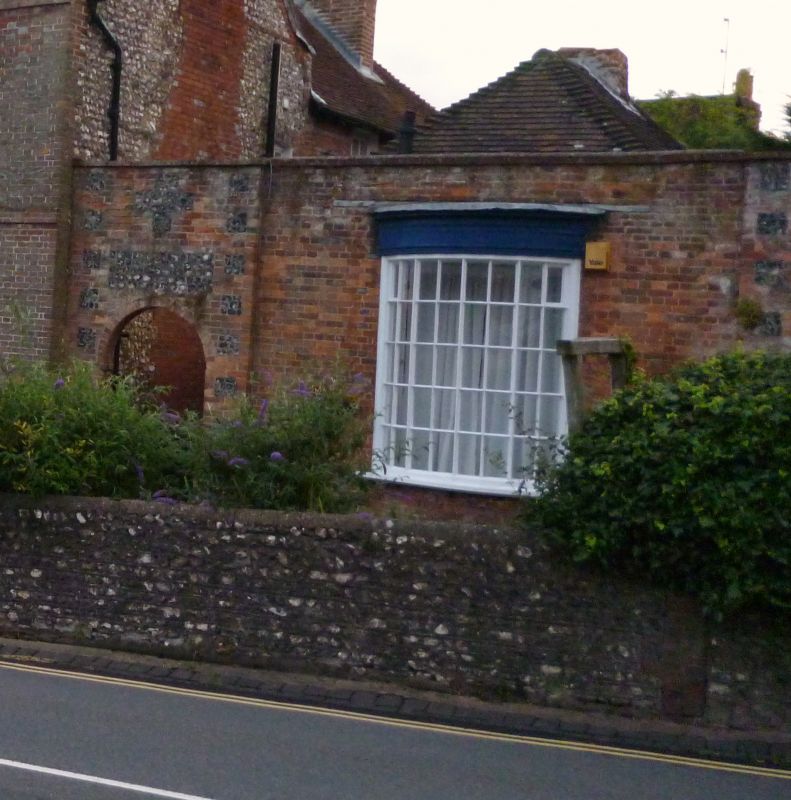
STEYNING HIGH STREET
1. (south-west side)
5404
No 17B
TQ 1711 24/128
II GV
2.
A former outbuilding of Penfold House, converted into an office. C18. One storey.
One window. Red brick. Parapet. Hipped tiled roof. Curved bay window with
glazing bars intact.
Listing NGR: TQ1777611091
External links are from the relevant listing authority and, where applicable, Wikidata. Wikidata IDs may be related buildings as well as this specific building. If you want to add or update a link, you will need to do so by editing the Wikidata entry.


Other nearby listed buildings
