Approximate Location Map
Large Map »
Latitude: 50.9573 / 50°57'26"N
Longitude: -0.4998 / 0°29'59"W
OS Eastings: 505460
OS Northings: 118610
OS Grid: TQ054186
Mapcode National: GBR GJ8.SKJ
Mapcode Global: FRA 96VL.13M
Plus Code: 9C2XXG42+W3
Entry Name: 109 and 111 Lower Street
Listing Date: 9 May 1980
Grade: II
Source: Historic England
Source ID: 1027346
English Heritage Legacy ID: 298574
ID on this website: 101027346
Location: Pulborough, Horsham, West Sussex, RH20
County: West Sussex
District: Horsham
Civil Parish: Pulborough
Built-Up Area: West Chiltington Common
Traditional County: Sussex
Lieutenancy Area (Ceremonial County): West Sussex
Church of England Parish: Pulborough St Mary
Church of England Diocese: Chichester
Tagged with: Building
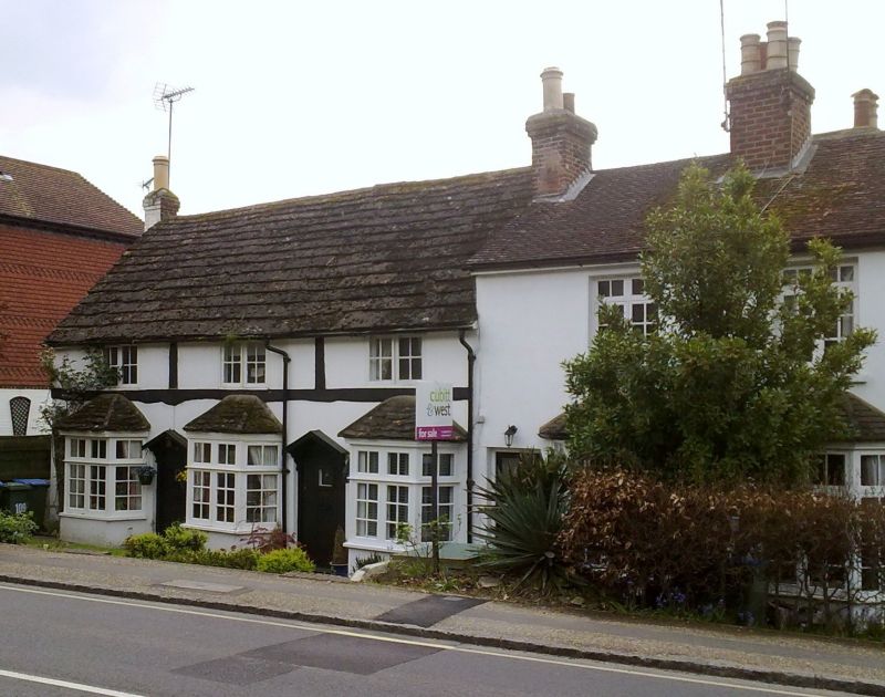
PULBOROUGH LOWER STREET (south side)
1.
5404
Nos 109 and 111
TQ 0518 17/711
II
2.
C17 timber-framed building, largely refaced with plaster, false modern timbering being applied to this. Horsham slab roof. Casement windows. Three modern bays on ground floor. Two storeys. Three windows.
Listing NGR: TQ0546018610
External links are from the relevant listing authority and, where applicable, Wikidata. Wikidata IDs may be related buildings as well as this specific building. If you want to add or update a link, you will need to do so by editing the Wikidata entry.


Other nearby listed buildings
