Approximate Location Map
Large Map »
Latitude: 50.8971 / 50°53'49"N
Longitude: -0.5427 / 0°32'33"W
OS Eastings: 502577
OS Northings: 111855
OS Grid: TQ025118
Mapcode National: GBR GJZ.MM6
Mapcode Global: FRA 96RQ.VR8
Plus Code: 9C2XVFW4+RW
Entry Name: The Turnpike
Listing Date: 9 May 1980
Grade: II
Source: Historic England
Source ID: 1027477
English Heritage Legacy ID: 298265
ID on this website: 101027477
Location: Amberley, Horsham, West Sussex, BN18
County: West Sussex
District: Horsham
Civil Parish: Amberley
Built-Up Area: Amberley
Traditional County: Sussex
Lieutenancy Area (Ceremonial County): West Sussex
Church of England Parish: Amberley with North Stoke
Church of England Diocese: Chichester
Tagged with: Building
AMBERLEY
HOUGHTON BRIDGE
1.
5404
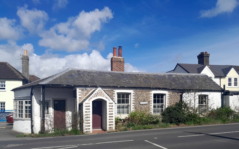
The Turnpike
TQ 01 SW 10/682
II
2.
Former toll-house. Early C19. One storey. Three windows. Faced with flints with
white brick dressings, easternmost window bay painted brick. Slate roof.
Glazing bars intact. Gabled porch.
Listing NGR: TQ0257711855
External links are from the relevant listing authority and, where applicable, Wikidata. Wikidata IDs may be related buildings as well as this specific building. If you want to add or update a link, you will need to do so by editing the Wikidata entry.


Other nearby listed buildings
