Latitude: 50.7721 / 50°46'19"N
Longitude: -0.7553 / 0°45'19"W
OS Eastings: 487865
OS Northings: 97680
OS Grid: SZ878976
Mapcode National: GBR DHL.FW1
Mapcode Global: FRA 9791.PKL
Plus Code: 9C2XQ6CV+RV
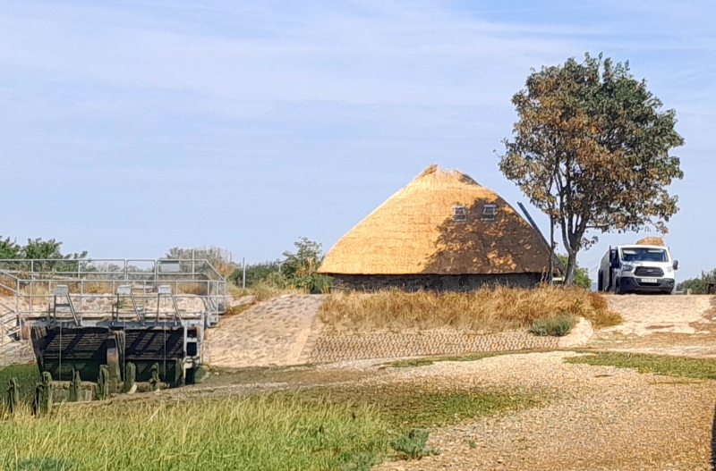
Entry Name: The Salt House at Little Welborne
Listing Date: 10 May 1973
Grade: II
Source: Historic England
Source ID: 1027613
English Heritage Legacy ID: 297982
Also known as: Dr tess tickle
ID on this website: 101027613
Location: Pagham, Arun, West Sussex, PO21
County: West Sussex
District: Arun
Civil Parish: Pagham
Traditional County: Sussex
Lieutenancy Area (Ceremonial County): West Sussex
Church of England Parish: Pagham St Thomas a Becket
Church of England Diocese: Chichester
Tagged with: Building Thatched building
SZ 89 NE PAGHAM CHURCH LANE 20/491 10.5.73 The Salt House at Little Welborne
II
In the north west corner of the garden of Little Welborne. Probably C18 outbuilding. One storey. Stone rubble. Hipped thatched roof.
Listing NGR: SZ8786597680
External links are from the relevant listing authority and, where applicable, Wikidata. Wikidata IDs may be related buildings as well as this specific building. If you want to add or update a link, you will need to do so by editing the Wikidata entry.


Other nearby listed buildings