Approximate Location Map
Large Map »
Latitude: 50.8941 / 50°53'38"N
Longitude: -0.5518 / 0°33'6"W
OS Eastings: 501944
OS Northings: 111508
OS Grid: TQ019115
Mapcode National: GBR FHM.Z5P
Mapcode Global: FRA 96QR.4TB
Plus Code: 9C2XVCVX+J7
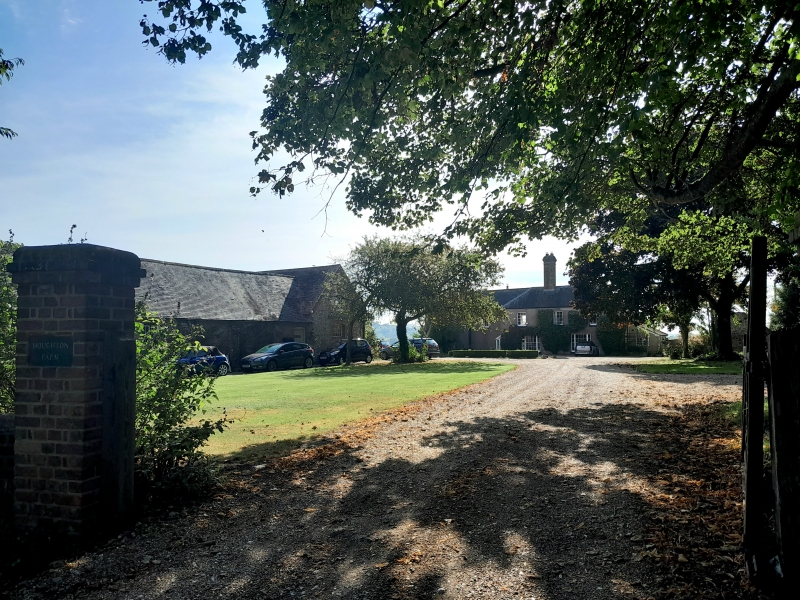
Entry Name: Houghton Farmhouse
Listing Date: 20 September 1984
Grade: II
Source: Historic England
Source ID: 1027635
English Heritage Legacy ID: 297935
ID on this website: 101027635
Location: Houghton, Arun, West Sussex, BN18
County: West Sussex
District: Arun
Civil Parish: Houghton
Traditional County: Sussex
Lieutenancy Area (Ceremonial County): West Sussex
Church of England Parish: Bury St John the Evangelist with Houghton St Nicholas
Church of England Diocese: Chichester
Tagged with: Farmhouse
TQ 0011 HOUGHTON THE STREET
21/258 (south side)
Houghton Farmhouse
II
L-shaped building with a C14 roof but altered and enlarged in the C19. Two storeys.
Five windows. Now faced with cement. Tiled roof on south side, slates on north.
Glazing bars intact. The south front, which is not now the entrance front, has a
two-storeyed gabled porch.
Listing NGR: TQ0194411508
External links are from the relevant listing authority and, where applicable, Wikidata. Wikidata IDs may be related buildings as well as this specific building. If you want to add or update a link, you will need to do so by editing the Wikidata entry.


Other nearby listed buildings
