Latitude: 50.829 / 50°49'44"N
Longitude: -0.4796 / 0°28'46"W
OS Eastings: 507176
OS Northings: 104377
OS Grid: TQ071043
Mapcode National: GBR GKT.ZH4
Mapcode Global: FRA 96WX.30P
Plus Code: 9C2XRGHC+J5
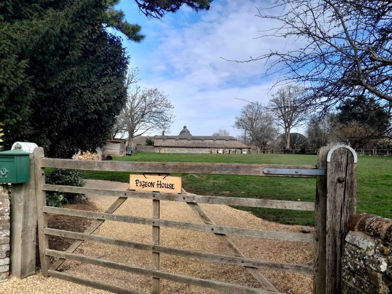
Entry Name: Barn to the East of the Pigeon House
Listing Date: 20 September 1984
Grade: II
Source: Historic England
Source ID: 1027720
English Heritage Legacy ID: 297731
ID on this website: 101027720
Location: Angmering, Arun, West Sussex, BN16
County: West Sussex
District: Arun
Civil Parish: Angmering
Built-Up Area: Littlehampton
Traditional County: Sussex
Lieutenancy Area (Ceremonial County): West Sussex
Church of England Parish: Angmering Saint Margaret with Ham and Bargham
Church of England Diocese: Chichester
Tagged with: Barn Thatched barn
TQ 0604 ANGMERING HIGH STREET 25/79B (north side) Barn to the east of the Pigeon House II Restored C18 building faced with modern weather-boarding on flint base. Hipped thatched roof.
Listing NGR: TQ0717604377
External links are from the relevant listing authority and, where applicable, Wikidata. Wikidata IDs may be related buildings as well as this specific building. If you want to add or update a link, you will need to do so by editing the Wikidata entry.


Other nearby listed buildings