Latitude: 50.8546 / 50°51'16"N
Longitude: -0.5598 / 0°33'35"W
OS Eastings: 501467
OS Northings: 107112
OS Grid: TQ014071
Mapcode National: GBR FJ6.99L
Mapcode Global: FRA 96QV.1QL
Plus Code: 9C2XVC3R+V3
Entry Name: The Victory Public House
Listing Date: 7 October 1974
Grade: II
Source: Historic England
Source ID: 1027933
English Heritage Legacy ID: 297154
ID on this website: 101027933
Location: Arundel, Arun, West Sussex, BN18
County: West Sussex
District: Arun
Civil Parish: Arundel
Built-Up Area: Arundel
Traditional County: Sussex
Lieutenancy Area (Ceremonial County): West Sussex
Church of England Parish: Arundel St Nicholas with Tortington
Church of England Diocese: Chichester
Tagged with: Pub
This list entry was subject to a Minor Amendment on 14 April 2026 to amend the name and address and reformat the text to current standards
TQ 0107
1/104
BOND STREET (south side)
No. 1, Victory Cottage
Former Victory Public House
(Formerly listed as Nos 1 and 3 (The Victory Public House))
GV
II
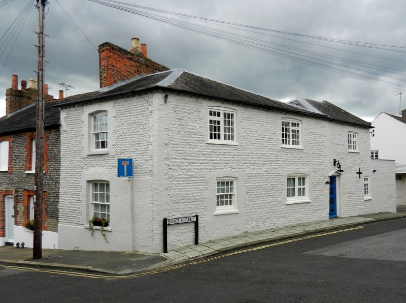
Early C19. Beach flint with brick dressings, whitewashed. Hipped slate roof. Brick chimneys. Two storeys. Brick modillion eaves cornice. Two windows on each floor, of which those on first floor have casements with glazing bars. Ground floor windows modern. One doorway with vestigial gabled hood over. One storey outhouse to west, connected with main block by brick wall. Beach flint with brick dressings. Pitched slate roof, with weatherboarded gable end. Walls and weatherboarding whitewashed. One door into outhouse, one door in wall.
Nos 1 to 23 (odd) and Nos 2 to 24 (even) form a group with Nos 24 to 30 (even)
King Street.
Listing NGR: TQ0146907109
External links are from the relevant listing authority and, where applicable, Wikidata. Wikidata IDs may be related buildings as well as this specific building. If you want to add or update a link, you will need to do so by editing the Wikidata entry.


Other nearby listed buildings