Approximate Location Map
Large Map »
Latitude: 50.862 / 50°51'43"N
Longitude: 0.352 / 0°21'7"E
OS Eastings: 565616
OS Northings: 109584
OS Grid: TQ656095
Mapcode National: GBR NVH.ZRS
Mapcode Global: FRA C6MT.GYB
Plus Code: 9F22V962+RQ
Entry Name: Brooks Farmhouse
Listing Date: 30 August 1966
Grade: II
Source: Historic England
Source ID: 1028516
English Heritage Legacy ID: 295716
ID on this website: 101028516
Location: Wartling, Wealden, East Sussex, BN27
County: East Sussex
District: Wealden
Civil Parish: Wartling
Traditional County: Sussex
Lieutenancy Area (Ceremonial County): East Sussex
Church of England Parish: Wartling St Mary Magdalene
Church of England Diocese: Chichester
Tagged with: Farmhouse
WARTLING WARTLING VILLAGE
1.
5208
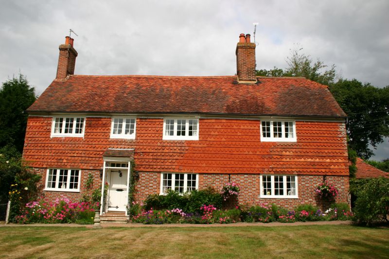
Brooks Farmhouse
TQ 60 NE 20/349 30.8.66
II
2.
C18 or earlier. Two storeys. Four windows. Ground floor red brick and grey
headers, above tile-hung. Tiled roof. Casement windows. Trellised wooden
porch.
Listing NGR: TQ6564509552
External links are from the relevant listing authority and, where applicable, Wikidata. Wikidata IDs may be related buildings as well as this specific building. If you want to add or update a link, you will need to do so by editing the Wikidata entry.


Other nearby listed buildings
