Latitude: 51.2931 / 51°17'35"N
Longitude: -0.326 / 0°19'33"W
OS Eastings: 516818
OS Northings: 156220
OS Grid: TQ168562
Mapcode National: GBR 7J.6J8
Mapcode Global: VHGRV.9RJK
Plus Code: 9C3X7MVF+7J
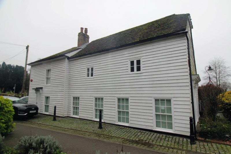
Entry Name: The White House
Listing Date: 7 September 1951
Grade: II
Source: Historic England
Source ID: 1028650
English Heritage Legacy ID: 290514
ID on this website: 101028650
Location: Leatherhead, Mole Valley, Surrey, KT22
County: Surrey
District: Mole Valley
Electoral Ward/Division: Leatherhead South
Parish: Non Civil Parish
Built-Up Area: Leatherhead
Traditional County: Surrey
Lieutenancy Area (Ceremonial County): Surrey
Church of England Parish: Leatherhead
Church of England Diocese: Guildford
Tagged with: House
LEATHERHEAD CHURCH ROAD TQ 1656 SE (south side) 12/120
7.9.51 No. 18 (The White House)
GV II
House and shop, now office. Earlier C18 with early C19 addition; altered. White- painted weatherboard, red tile roof. Linear plan in 2 parts on north-south axis, with various rear extensions, on a small triangular island site: the earlier element rectangular with a continuous rear outshut, the later (a dwelling) trapezoidal and double-depth. Two storeys, 1+2 first floor windows; the added dwelling has a plain doorway under a cornice on consoles, one sashed window with margin panes on each floor to the right, and a chimney at the junction of the roofs; and the gable wall, which is canted back, has similar fenestration. The main range has four 12-pane sashes at ground floor, 2 small 2-light casements above, and a steeply-pitched roof with a half-hip; its north gable wall has a former shop window consisting of tripartite 8-pane sashes under a blank fascia set in a large square moulded surround with reeded pilasters and a very prominent moulded cornice on consoles, and a small casement under the hip. Interior not inspected. Formerly a grocer's shop known as "Jenden's Corner".
Listing NGR: TQ1681856220
External links are from the relevant listing authority and, where applicable, Wikidata. Wikidata IDs may be related buildings as well as this specific building. If you want to add or update a link, you will need to do so by editing the Wikidata entry.


Other nearby listed buildings