Latitude: 51.2317 / 51°13'54"N
Longitude: -0.3318 / 0°19'54"W
OS Eastings: 516569
OS Northings: 149382
OS Grid: TQ165493
Mapcode National: GBR HGJ.LY7
Mapcode Global: VHGS7.69GL
Plus Code: 9C3X6MJ9+M7
Entry Name: 62 and 64, High Street
Listing Date: 11 June 1973
Grade: II
Source: Historic England
Source ID: 1028857
English Heritage Legacy ID: 289911
ID on this website: 101028857
Location: Dorking, Mole Valley, Surrey, RH4
County: Surrey
District: Mole Valley
Electoral Ward/Division: Dorking South
Parish: Non Civil Parish
Built-Up Area: Dorking
Traditional County: Surrey
Lieutenancy Area (Ceremonial County): Surrey
Church of England Parish: Dorking St Martin
Church of England Diocese: Guildford
Tagged with: Building
HIGH STREET 1. 1049 (South-East Side) Nos 62 and 64 TQ 1649 SE 1/5
II GV
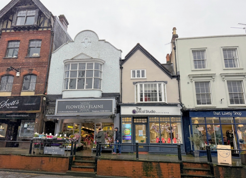
2. Probably timber-framed building now fronted with plaster and imitation timbering and much defaced. 2 storeys. 1 window. Gable and parapet to the south-east of it. Tiled roof. Modern shop front and advertisement above it. Photograph in NMR.
Nos 40 to 64 (even) form a group.
Listing NGR: TQ1656949382
External links are from the relevant listing authority and, where applicable, Wikidata. Wikidata IDs may be related buildings as well as this specific building. If you want to add or update a link, you will need to do so by editing the Wikidata entry.


Other nearby listed buildings