Latitude: 51.2378 / 51°14'15"N
Longitude: -0.2094 / 0°12'33"W
OS Eastings: 525097
OS Northings: 150254
OS Grid: TQ250502
Mapcode National: GBR JJ0.7W3
Mapcode Global: VHGS9.B44Z
Plus Code: 9C3X6QQR+46
Entry Name: 61 and 63, High Street
Listing Date: 31 March 1977
Grade: II
Source: Historic England
Source ID: 1029081
English Heritage Legacy ID: 289358
ID on this website: 101029081
Location: Reigate, Reigate and Banstead, Surrey, RH2
County: Surrey
District: Reigate and Banstead
Electoral Ward/Division: Reigate Central
Parish: Non Civil Parish
Built-Up Area: Reigate
Traditional County: Surrey
Lieutenancy Area (Ceremonial County): Surrey
Church of England Parish: Reigate
Church of England Diocese: Southwark
Tagged with: Building
HIGH STREET 1. 5388 (South Side) Reigate Nos 61 and 63 TQ 2550 SW 12/186
II
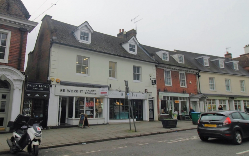
2. C18 with alterations. 2 storeys and attic, 3 windows. Stucco front with incised lines and raised quoins. Roof of banded plain and diamond tiling, 2 gabled dormers of early C19. Replaced 1st floor sash windows with vertical bars. 2 modern shop fronts below.
Listing NGR: TQ2509950251
External links are from the relevant listing authority and, where applicable, Wikidata. Wikidata IDs may be related buildings as well as this specific building. If you want to add or update a link, you will need to do so by editing the Wikidata entry.


Other nearby listed buildings