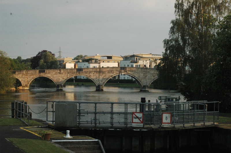
Latitude: 51.3889 / 51°23'20"N
Longitude: -0.4865 / 0°29'11"W
OS Eastings: 505407
OS Northings: 166625
OS Grid: TQ054666
Mapcode National: GBR 1G.81J
Mapcode Global: VHFTX.JC53
Plus Code: 9C3X9GQ7+H9
Entry Name: Chertsey Bridge
Listing Date: 26 September 1951
Grade: II
Source: Historic England
Source ID: 1029204
English Heritage Legacy ID: 289145
ID on this website: 101029204
Location: Addlestonemoor, Runnymede, Surrey, KT16
County: Surrey
District: Runnymede
Electoral Ward/Division: Chertsey St Ann's
Parish: Non Civil Parish
Built-Up Area: Chertsey
Traditional County: Surrey
Lieutenancy Area (Ceremonial County): Surrey
Church of England Parish: Chertsey
Church of England Diocese: Guildford
1. Chertsey Bridge 966 (that part in the Urban District of Chertsey) TQ 0566 9/43 26.9.5l. II
2. Built by James Paine 1780-85. Stone. 5 principal segmental arches with additional flood arches at sides. Plain parapet, with capping and cast iron ornamental panels. The latter are above cutwaters, which are pointed on plan and have rounded tops at springing of arches. Bridge has good proportions. NMR photo.
Listing NGR: TQ0540766625


Other nearby listed buildings