Latitude: 51.3684 / 51°22'6"N
Longitude: -0.3969 / 0°23'48"W
OS Eastings: 511693
OS Northings: 164478
OS Grid: TQ116644
Mapcode National: GBR 4V.DMP
Mapcode Global: VHFTZ.2VJW
Plus Code: 9C3X9J93+96
Entry Name: The Barley Mow Public House
Listing Date: 16 April 1970
Grade: II
Source: Historic England
Source ID: 1030167
English Heritage Legacy ID: 286804
ID on this website: 101030167
Location: Hersham, Elmbridge, Surrey, KT12
County: Surrey
District: Elmbridge
Electoral Ward/Division: Hersham Village
Parish: Non Civil Parish
Built-Up Area: Walton-on-Thames
Traditional County: Surrey
Lieutenancy Area (Ceremonial County): Surrey
Church of England Parish: Hersham
Church of England Diocese: Guildford
Tagged with: Pub
TQ 16SW BOROUGH OF ELMBRIDGE MOLESEY ROAD
Hersham
5/227 The Barley Mow 16.4.70 Public House
II
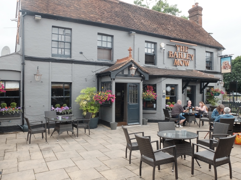
Public house. Mid C18. Whitewashed brick on rendered plinth with plain tiled roof. Ridge stack left of centre, end stack to right. 2 storeys , moulded wooden band over ground floor 6 bays. 4 glazing bar sash windows across the first floor with two blocked windows to right of centre. Ground floor sash windows. Angle bay to right of centre. Half glazed door to right under tiled pentice roof on wooden brackets which extends over angle bay window. 2 half glazed doors in C19 gable front porch with tiled ridge cresting and gable finial to left of centre. Pan tiled catslide extension to rear. C20 additions to right hand return front, and rear right.
Listing NGR: TQ1169364478
External links are from the relevant listing authority and, where applicable, Wikidata. Wikidata IDs may be related buildings as well as this specific building. If you want to add or update a link, you will need to do so by editing the Wikidata entry.


Other nearby listed buildings