Latitude: 52.0257 / 52°1'32"N
Longitude: 1.4402 / 1°26'24"E
OS Eastings: 636104
OS Northings: 241955
OS Grid: TM361419
Mapcode National: GBR WR3.YS8
Mapcode Global: VHM8L.XB7X
Plus Code: 9F432CGR+73
Entry Name: Martello Tower at TM 361 419
Listing Date: 31 August 1988
Grade: II
Source: Historic England
Source ID: 1030773
English Heritage Legacy ID: 285373
ID on this website: 101030773
Location: Shingle Street, East Suffolk, IP12
County: Suffolk
District: East Suffolk
Civil Parish: Alderton
Traditional County: Suffolk
Lieutenancy Area (Ceremonial County): Suffolk
Church of England Parish: Alderton St Andrew
Church of England Diocese: St.Edmundsbury and Ipswich
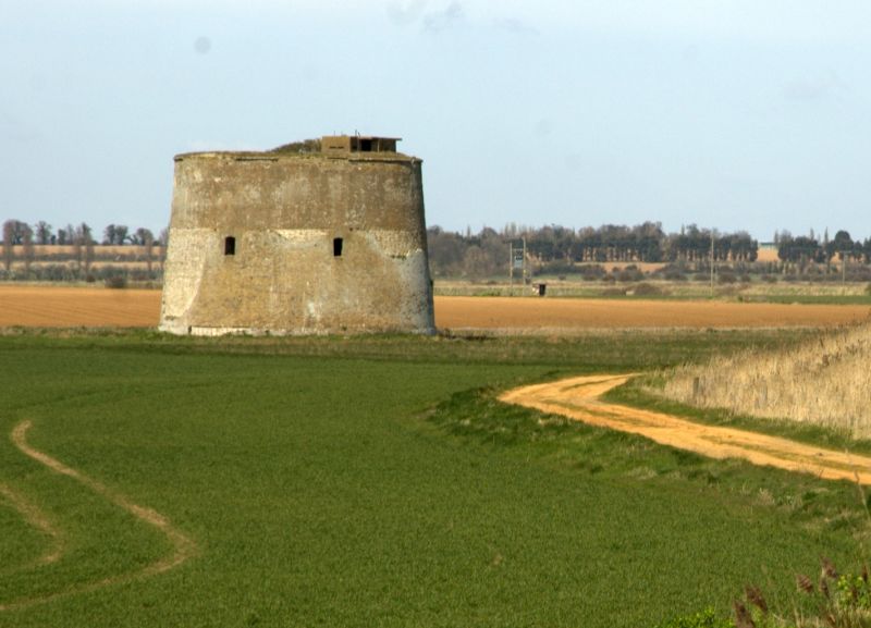
ALDERTON TM 34 SE 11/10A Martello Tower at TM 361 419 GV II Defensive tower. c.1810-1812. Col. Twiss and Capt. Ford. Yellow brick with ashlar dressings. Three storeys. Tear-drop-shaped plan, the sharper end facing east towards the sea. Battered walls. At first floor level are a series of 4 window openings with cambered heads which have slightly projecting ashlar surrounds with lugs to the top, centre and bottom of each side. At the same level and facing west is a doorway with ashlar surround and an inset ashlar ladder-slope below the cill. On the roof of this tower is a gun emplacement of c.1939-45 built of reinforced concrete having a projecting centre and recessed flanking walls with gun slits.
Listing NGR: TM3610041900


Other nearby listed buildings