Latitude: 51.4067 / 51°24'24"N
Longitude: -1.8312 / 1°49'52"W
OS Eastings: 411837
OS Northings: 167530
OS Grid: SU118675
Mapcode National: GBR 3VS.RV5
Mapcode Global: VHB45.6XS0
Plus Code: 9C3WC549+MG
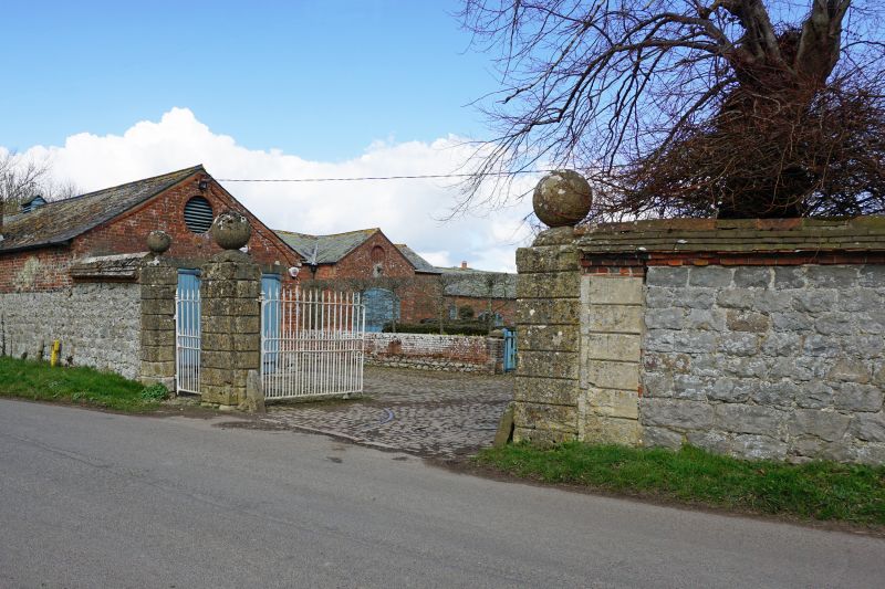
Entry Name: Stable Yard Walls and Gate Piers, East Kennett Manor
Listing Date: 29 April 1987
Grade: II
Source: Historic England
Source ID: 1033708
English Heritage Legacy ID: 311574
ID on this website: 101033708
Location: East Kennett, Wiltshire, SN8
County: Wiltshire
Civil Parish: East Kennett
Traditional County: Wiltshire
Lieutenancy Area (Ceremonial County): Wiltshire
Tagged with: Stable
EAST KENNETT VILLAGE CENTRE SU 16 NW (east end) 5/153 Stable yard walls and gate piers, East Kennett Manor
GV II
Road-side wall west of East Kennett Manor (q.v.). C18. Squared sarsen with 3-course tile copings and ridge over 2 brick offsetting courses. Wall approximately 2m high and 12m long terminating in 3 rebuilt rusticated limestone gate piers with large ball finials, the cornices and bases removed. Continued to south as south garden walls (q.v.).
Listing NGR: SU1183767530
External links are from the relevant listing authority and, where applicable, Wikidata. Wikidata IDs may be related buildings as well as this specific building. If you want to add or update a link, you will need to do so by editing the Wikidata entry.


Other nearby listed buildings