Latitude: 51.3762 / 51°22'34"N
Longitude: -1.9485 / 1°56'54"W
OS Eastings: 403681
OS Northings: 164131
OS Grid: SU036641
Mapcode National: GBR 3W1.L70
Mapcode Global: VHB49.5NRV
Plus Code: 9C3W93G2+FJ
Entry Name: Blackwells Farmhouse
Listing Date: 29 April 1987
Grade: II
Source: Historic England
Source ID: 1033741
English Heritage Legacy ID: 311545
ID on this website: 101033741
Location: Bishops Cannings, Wiltshire, SN10
County: Wiltshire
Civil Parish: Bishops Cannings
Traditional County: Wiltshire
Lieutenancy Area (Ceremonial County): Wiltshire
Church of England Parish: Bishop's Cannings and Etchilhampton St Mary the Virgin
Church of England Diocese: Salisbury
Tagged with: Farmhouse Thatched farmhouse
BISHOPS CANNINGS CHANDLERS LANE
SU 06 SW (west side)
6/124 Blackwells Farmhouse
GV II
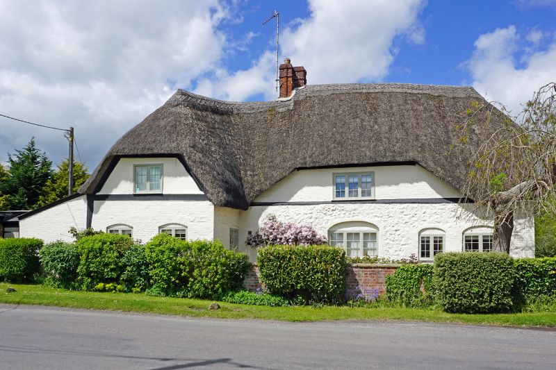
Farmhouse. C16-C17. Colourwashed sarsen with brick dressings,
wing timber framed mostly replaced in brick. Thatched roof.
Single storey and attics, 2 bays with gable half-bay for lobby
entry and stack, and cross wing beyond stack of 2 bays. Lean-to
extensions on left and to rear. Entrance in C20 addition at rear
probably covering original lobby entry. Timber casement windows
within cambered head openings, and wide flush dormer on first
floor. Roof half hipped to right and over forward gable.
Interior has large chalkstone stack in original hall, with 2 spine
beams bearing on timber framed partition, now opened, to inner bay
on right.
Listing NGR: SU0368164131
External links are from the relevant listing authority and, where applicable, Wikidata. Wikidata IDs may be related buildings as well as this specific building. If you want to add or update a link, you will need to do so by editing the Wikidata entry.


Other nearby listed buildings