Approximate Location Map
Large Map »
Latitude: 51.4592 / 51°27'33"N
Longitude: -1.7158 / 1°42'56"W
OS Eastings: 419840
OS Northings: 173393
OS Grid: SU198733
Mapcode National: GBR 4WP.K0D
Mapcode Global: VHC1H.6LS8
Plus Code: 9C3WF75M+MM
Entry Name: Elm Tree Cottage
Listing Date: 2 September 1986
Grade: II
Source: Historic England
Source ID: 1033824
English Heritage Legacy ID: 311339
ID on this website: 101033824
Location: Southend, Wiltshire, SN8
County: Wiltshire
Civil Parish: Ogbourne St. George
Traditional County: Wiltshire
Lieutenancy Area (Ceremonial County): Wiltshire
Tagged with: Cottage Thatched cottage
OGBOURNE ST GEORGE A345 (east side), Southend
SU 17 SE 7/87
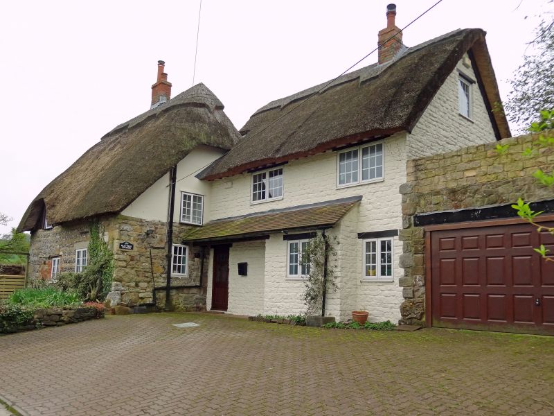
Elm Tree Cottage
GV II
Cottage. C17. Flint banded with sarsen and limestone. Thatched roof. Single storey and attic, 2 bays. Gable entry and 1 central stack. Timber-paned windows, replaced with aluminium on east. West gable timber framed and rendered. Roof half-hipped both ends.
Listing NGR: SU1984073393
External links are from the relevant listing authority and, where applicable, Wikidata. Wikidata IDs may be related buildings as well as this specific building. If you want to add or update a link, you will need to do so by editing the Wikidata entry.


Other nearby listed buildings
