Approximate Location Map
Large Map »
Latitude: 51.4421 / 51°26'31"N
Longitude: -1.6059 / 1°36'21"W
OS Eastings: 427488
OS Northings: 171529
OS Grid: SU274715
Mapcode National: GBR 5YC.GV1
Mapcode Global: VHC1R.30WT
Plus Code: 9C3WC9RV+RJ
Entry Name: 9, High Street
Listing Date: 22 August 1966
Grade: II
Source: Historic England
Source ID: 1034090
English Heritage Legacy ID: 310655
ID on this website: 101034090
Location: Ramsbury, Wiltshire, SN8
County: Wiltshire
Civil Parish: Ramsbury
Built-Up Area: Ramsey
Traditional County: Wiltshire
Lieutenancy Area (Ceremonial County): Wiltshire
Tagged with: Building
SU 27 SE RAMSBURY HIGH STREET
(south side)
10/197 No 9
22.8.66
GV II
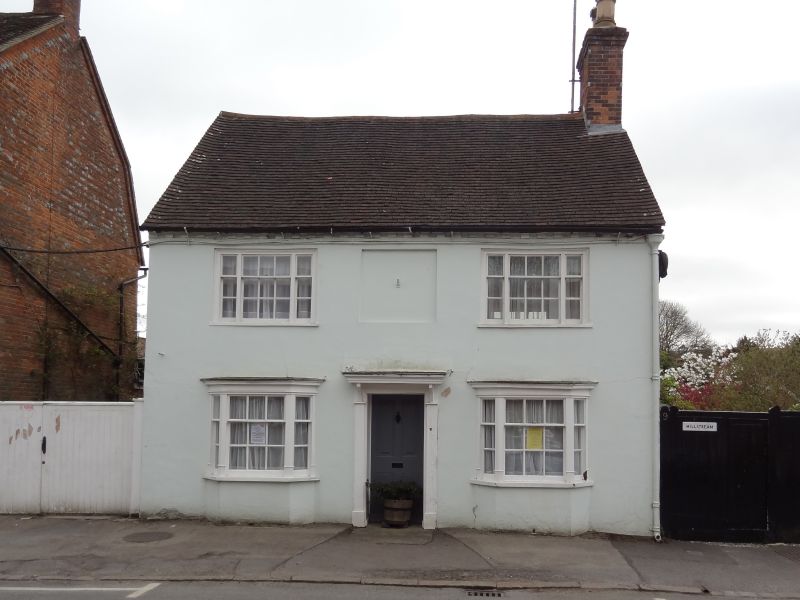
House, C18-C19. Brick laced flint with painted stucco. Plain tile
roof. 2-storey 3 bays, central door, 4-panelled with fluted
doorcase and bracketed canopy. Ground floor canted 9-pane sashes
and tripartite 9-pane sashes to first floor. Right gable stack.
Listing NGR: SU2749471513
External links are from the relevant listing authority and, where applicable, Wikidata. Wikidata IDs may be related buildings as well as this specific building. If you want to add or update a link, you will need to do so by editing the Wikidata entry.


Other nearby listed buildings
