Latitude: 51.4261 / 51°25'33"N
Longitude: -1.677 / 1°40'37"W
OS Eastings: 422551
OS Northings: 169722
OS Grid: SU225697
Mapcode National: GBR 5YG.GV2
Mapcode Global: VHC1P.WF84
Plus Code: 9C3WC8GF+C5
Entry Name: Grove Farmhouse
Listing Date: 6 March 1985
Grade: II
Source: Historic England
Source ID: 1034114
English Heritage Legacy ID: 310611
ID on this website: 101034114
Location: Stitchcombe, Wiltshire, SN8
County: Wiltshire
Civil Parish: Mildenhall
Traditional County: Wiltshire
Lieutenancy Area (Ceremonial County): Wiltshire
Tagged with: Farmhouse
SU 26 NW MILDENHALL GROVE LANE
6/148 Grove Farmhouse
II
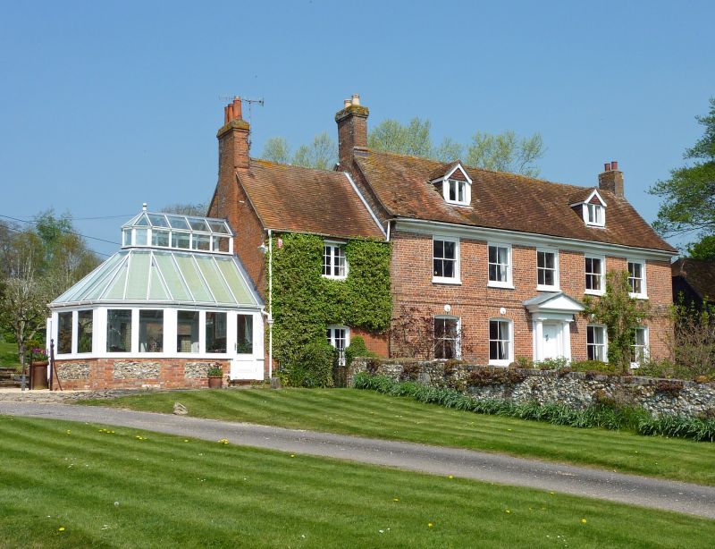
Farmhouse, C18. Flemish bond brickwork, tiled roof. 2-storey and attic, 5 bays, with left extension of 2-storey 1 bay. Central C19 6-panelled door with flat portico on slender iron columns and terminal blocks over canopy. 4-pane sashes with segmental brick heads, plat band and moulded timber cornice. 2 disk tie ends. 2 gabled dormers and gable stacks. Extension has casement windows and gable stack.
Listing NGR: SU2255169722
External links are from the relevant listing authority and, where applicable, Wikidata. Wikidata IDs may be related buildings as well as this specific building. If you want to add or update a link, you will need to do so by editing the Wikidata entry.


Other nearby listed buildings