Approximate Location Map
Large Map »
Latitude: 51.4804 / 51°28'49"N
Longitude: -1.6213 / 1°37'16"W
OS Eastings: 426397
OS Northings: 175781
OS Grid: SU263757
Mapcode National: GBR 5XY.4X5
Mapcode Global: VHC1J.V18Z
Plus Code: 9C3WF9JH+5F
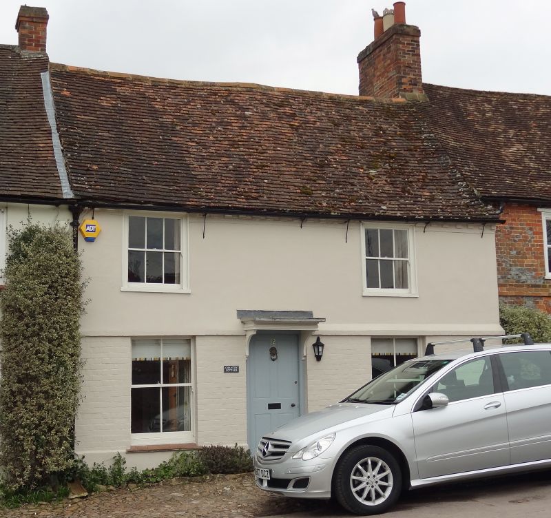
Entry Name: Chantry Cottage
Listing Date: 22 August 1966
Grade: II
Source: Historic England
Source ID: 1034151
English Heritage Legacy ID: 310497
ID on this website: 101034151
Location: Aldbourne, Wiltshire, SN8
County: Wiltshire
Civil Parish: Aldbourne
Built-Up Area: Aldbourne
Traditional County: Wiltshire
Lieutenancy Area (Ceremonial County): Wiltshire
Tagged with: Cottage
SU 27 NE ALDBOURNE THE GREEN
(west side)
9/37 No 12 (Chantry Cottage)
22.8.66
GV II
House in row, C16-C17, largely rebuilt in late C18. Brick with
stucco first floor. Tiled roof. 2-storey 2 bays 2 rooms deep.
Central 4-panelled door with bracketed and moulded canopy. 4-pane
sashes and 6-pane to first floor. Brick dentilled eaves. Right
external gable stack.
Listing NGR: SU2639675778
External links are from the relevant listing authority and, where applicable, Wikidata. Wikidata IDs may be related buildings as well as this specific building. If you want to add or update a link, you will need to do so by editing the Wikidata entry.


Other nearby listed buildings
