Approximate Location Map
Large Map »
Latitude: 51.4238 / 51°25'25"N
Longitude: -1.7315 / 1°43'53"W
OS Eastings: 418762
OS Northings: 169453
OS Grid: SU187694
Mapcode National: GBR 4X2.M1N
Mapcode Global: VHB46.XGZW
Plus Code: 9C3WC7F9+G9
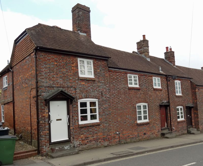
Entry Name: 17-21 Kingsbury Street
Listing Date: 21 October 1974
Grade: II
Source: Historic England
Source ID: 1034197
English Heritage Legacy ID: 310405
ID on this website: 101034197
Location: Marlborough, Wiltshire, SN8
County: Wiltshire
Civil Parish: Marlborough
Built-Up Area: Marlborough
Traditional County: Wiltshire
Lieutenancy Area (Ceremonial County): Wiltshire
Tagged with: Building
KINGSBURY STREET (East Side)
1. 5407
SU 1869 1/211
Nos 17 to 21 (consec)
GV II
2.
C18/early Cl9. Chequer brick. Pitched tile roof. Brick stacks. 2 storeys. Oversailing course at eaves. Each cottage has 1 range of casements with glazing bars. No 18 has 1 extra on 1st floor. 1 planked door each with gabled hood on scroll-shaped brackets, No 17's a small porch. Each door has 3 ashlar steps up. Nos 17 to 34 (consec) form a group.
Listing NGR: SU1876269453
External links are from the relevant listing authority and, where applicable, Wikidata. Wikidata IDs may be related buildings as well as this specific building. If you want to add or update a link, you will need to do so by editing the Wikidata entry.


Other nearby listed buildings
