Latitude: 51.4211 / 51°25'15"N
Longitude: -1.731 / 1°43'51"W
OS Eastings: 418797
OS Northings: 169156
OS Grid: SU187691
Mapcode National: GBR 4X2.TD0
Mapcode Global: VHB46.YJ7Y
Plus Code: 9C3WC7C9+CH
Entry Name: 131, High Street
Listing Date: 21 October 1974
Grade: II
Source: Historic England
Source ID: 1034229
English Heritage Legacy ID: 310380
ID on this website: 101034229
Location: Marlborough, Wiltshire, SN8
County: Wiltshire
Civil Parish: Marlborough
Built-Up Area: Marlborough
Traditional County: Wiltshire
Lieutenancy Area (Ceremonial County): Wiltshire
Tagged with: Building
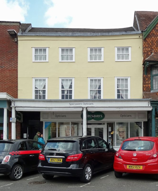
HIGH STREET
1.
5407
(North Side)
No l3l
SU 1869 1/40
II GV
2.
Cl8. 3 storey. Stucco with moulded coping and lead gutter at top. Old tile
roof. 4 windows to upper floors. C19 plain shop front on ground floor under
pent roof supported by Doric columns.
Nos 131 to 144 (consec)and Midland Bank form a group, with the Town Hall and
Nos 1 to 12 (consec), opposite.
Listing NGR: SU1879269161
External links are from the relevant listing authority and, where applicable, Wikidata. Wikidata IDs may be related buildings as well as this specific building. If you want to add or update a link, you will need to do so by editing the Wikidata entry.


Other nearby listed buildings