Approximate Location Map
Large Map »
Latitude: 51.4222 / 51°25'19"N
Longitude: -1.7287 / 1°43'43"W
OS Eastings: 418960
OS Northings: 169278
OS Grid: SU189692
Mapcode National: GBR 4X2.V19
Mapcode Global: VHB46.ZJG3
Plus Code: 9C3WC7CC+VG
Entry Name: 30-32, the Green
Listing Date: 21 October 1974
Grade: II
Source: Historic England
Source ID: 1034238
English Heritage Legacy ID: 310306
ID on this website: 101034238
Location: Marlborough, Wiltshire, SN8
County: Wiltshire
Civil Parish: Marlborough
Built-Up Area: Marlborough
Traditional County: Wiltshire
Lieutenancy Area (Ceremonial County): Wiltshire
Tagged with: Building
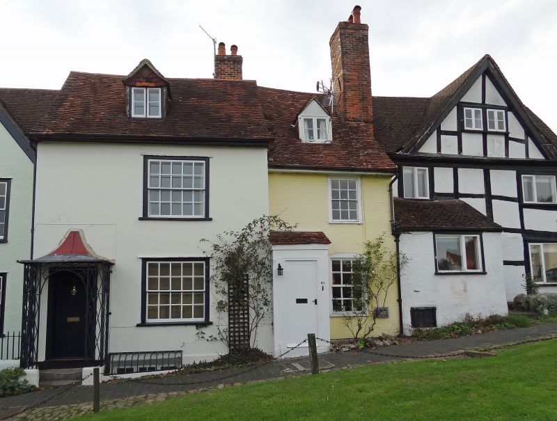
THE GREEN
1.
5407
(West Side)
Nos 30 to 32 (consec)
SU 1869 1/82
II GV
2.
Cl7. 2 storey and attic. Stucco and colour washed brick. Old tile roofs. Gabled
dormers. Irregular sash windows and plain doors. No 32 has gable facing The
Green and some stone tiles in roof. Picturesque.
Nos 19 to 32 (consec) form a group.
Listing NGR: SU1896069272
External links are from the relevant listing authority and, where applicable, Wikidata. Wikidata IDs may be related buildings as well as this specific building. If you want to add or update a link, you will need to do so by editing the Wikidata entry.


Other nearby listed buildings
