Latitude: 50.6666 / 50°39'59"N
Longitude: -1.1841 / 1°11'2"W
OS Eastings: 457758
OS Northings: 85531
OS Grid: SZ577855
Mapcode National: GBR 9DD.1GY
Mapcode Global: FRA 87D9.Y87
Plus Code: 9C2WMR88+J9
Entry Name: Alverstone Bridge
Listing Date: 14 February 1992
Grade: II
Source: Historic England
Source ID: 1034313
English Heritage Legacy ID: 310176
ID on this website: 101034313
Location: Alverstone, Isle of Wight, PO36
County: Isle of Wight
Civil Parish: Newchurch
Traditional County: Hampshire
Lieutenancy Area (Ceremonial County): Isle of Wight
Church of England Parish: Brading St Mary the Virgin
Church of England Diocese: Portsmouth
Tagged with: Bridge
NEWCHURCH SZS8NE ALVERSTONE ROAD 1352-0/1/139 Alverstone Bridge II
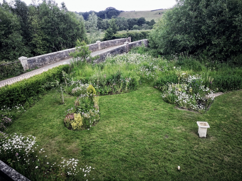
Bridge. Early C19. Built of tooled ashlar. One large round-headed arch to south with stone voussoirs and keystone and smaller similar arch to north. (2 further small arches reported to north but concealed under nettles at time of survey.) Parapet of 3 courses with triangular-headed ashlar coping and 3 square piers with pyramidal caps to each side.
Listing NGR: SZ5775885531
External links are from the relevant listing authority and, where applicable, Wikidata. Wikidata IDs may be related buildings as well as this specific building. If you want to add or update a link, you will need to do so by editing the Wikidata entry.


Other nearby listed buildings