Latitude: 51.3491 / 51°20'56"N
Longitude: -1.7958 / 1°47'45"W
OS Eastings: 414314
OS Northings: 161132
OS Grid: SU143611
Mapcode National: GBR 4XY.8T1
Mapcode Global: VHB4K.TCG4
Plus Code: 9C3W86X3+JM
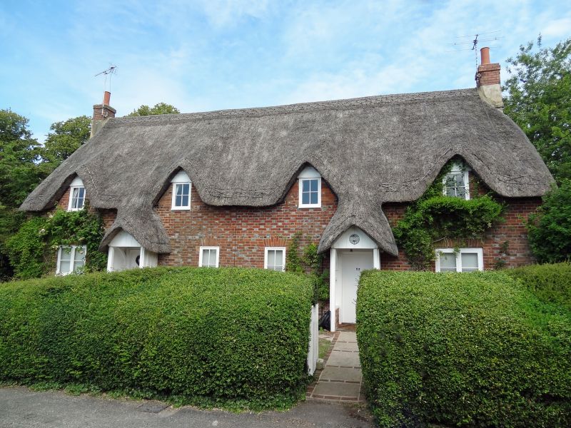
Entry Name: 23 and 24, the Green
Listing Date: 15 May 1979
Grade: II
Source: Historic England
Source ID: 1035744
English Heritage Legacy ID: 311801
ID on this website: 101035744
Location: Wilcot, Wiltshire, SN9
County: Wiltshire
Civil Parish: Wilcot
Traditional County: Wiltshire
Lieutenancy Area (Ceremonial County): Wiltshire
Tagged with: Building Thatched cottage
WILCOT THE GREEN SU 16 SW (east side)
5/164 Nos 23 and 24 15.5.79 GV II
Pair of estate cottages. Late C18. Diaper brickwork with thatched roof. Single storey and attic, each cottage of 2 bays. Boarded doors in open thatched brick and wood porches. Paned casement windows. Thatch pointed over 4 flush dormers. Gable stacks.
Listing NGR: SU1431461132
External links are from the relevant listing authority and, where applicable, Wikidata. Wikidata IDs may be related buildings as well as this specific building. If you want to add or update a link, you will need to do so by editing the Wikidata entry.


Other nearby listed buildings