Latitude: 51.2863 / 51°17'10"N
Longitude: -1.9802 / 1°58'48"W
OS Eastings: 401479
OS Northings: 154124
OS Grid: SU014541
Mapcode National: GBR 2VT.B61
Mapcode Global: VHB4N.MXJV
Plus Code: 9C3W72P9+GW
Entry Name: The Vicarage
Listing Date: 19 March 1962
Grade: II
Source: Historic England
Source ID: 1035832
English Heritage Legacy ID: 312030
ID on this website: 101035832
Location: Market Lavington, Wiltshire, SN10
County: Wiltshire
Civil Parish: Market Lavington
Built-Up Area: Market Lavington
Traditional County: Wiltshire
Lieutenancy Area (Ceremonial County): Wiltshire
Tagged with: Clergy house
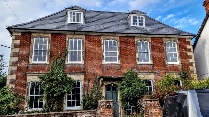
MARKET LAVINGTON CHURCH STREET SU 0054-0154 (north side) 12/124 The Vicarage 19.3.62 GV II House, since 1945 the vicarage. c1710-30. Flemish bond brickwork with raised stone quoins and dressings. Two storeys, cellars and attics, five bays. Central stair hall with flanking reception rooms and kitchen wing to right at rear. Central 6-panelled door with segmental head and stone architrave. Flat stone canopy on brackets. Twelve-paned sash windows, also with stone architraves, segmental heads and keyblocks. Heads of ground floor windows raised to stone cornice. Boxed eaves. Roof hipped; with two hipped dormers. Interior has early C18 dog leg stair. Bead moulded stone fireplace in left sitting room. Chamfered ceiling beam to right room, and a deep chamfered spine beam with bar stops to kitchen, probably reused. Rear door C18, panelled, now enclosed in C20 domestic extensions.
Listing NGR: SU0147654128
External links are from the relevant listing authority and, where applicable, Wikidata. Wikidata IDs may be related buildings as well as this specific building. If you want to add or update a link, you will need to do so by editing the Wikidata entry.


Other nearby listed buildings