Latitude: 52.1159 / 52°6'57"N
Longitude: 0.8697 / 0°52'10"E
OS Eastings: 596578
OS Northings: 250287
OS Grid: TL965502
Mapcode National: GBR RJ2.BPH
Mapcode Global: VHKF0.124R
Plus Code: 9F424V89+9V
Entry Name: Church of St Mary
Listing Date: 23 January 1958
Grade: I
Source: Historic England
Source ID: 1037253
English Heritage Legacy ID: 276628
Also known as: St Mary the Virgin, Kettlebaston
ID on this website: 101037253
Location: St Mary's Church, Kettlebaston, Babergh, Suffolk, IP7
County: Suffolk
District: Babergh
Civil Parish: Kettlebaston
Traditional County: Suffolk
Lieutenancy Area (Ceremonial County): Suffolk
Church of England Parish: Kettlebaston
Church of England Diocese: St.Edmundsbury and Ipswich
Tagged with: Church building
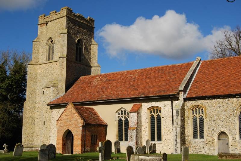
KETTLEBASTON 1 5377 Church of St Mary TL 9650 49/481 23.1.58 I GV 2. A flint and stone church with a nave of Norman origin but with mainly C14 detail. The west tower is C14, with diagonal buttresses and castellated parapet. Roofs tiled. The south doorway is late Norman with shafts and scalloped capitals. The chancel is C14. The east window is of 1902, probably a replacement of an original window. (The ogee tracery is similar to that in the bell openings in the west tower). The interior has a Norman font, square, an ogee arched tomb recess in the north wall and the remains of C13 wall painting. Some fine alabaster panels were found embedded in the walls in the C19 and are now in the British Museum. Graded for its architectural and historical importance.
Listing NGR: TL9657850287
External links are from the relevant listing authority and, where applicable, Wikidata. Wikidata IDs may be related buildings as well as this specific building. If you want to add or update a link, you will need to do so by editing the Wikidata entry.


Other nearby listed buildings