Approximate Location Map
Large Map »
Latitude: 52.6567 / 52°39'24"N
Longitude: -2.5029 / 2°30'10"W
OS Eastings: 366076
OS Northings: 306676
OS Grid: SJ660066
Mapcode National: GBR BV.5QJ1
Mapcode Global: WH9D8.JHB3
Plus Code: 9C4VMF4W+MR
Entry Name: Lower Coalmoor Farmhouse
Listing Date: 8 April 1983
Grade: II
Source: Historic England
Source ID: 1038257
English Heritage Legacy ID: 362287
ID on this website: 101038257
Location: Coalmoor, Telford and Wrekin, Shropshire, TF4
County: Telford and Wrekin
Civil Parish: Little Wenlock
Traditional County: Shropshire
Lieutenancy Area (Ceremonial County): Shropshire
Church of England Parish: Little Wenlock
Church of England Diocese: Hereford
Tagged with: Farmhouse
LITTLE WENLOCK COALMOOR
1.
5362 Lower Coalmoor Farmhouse
SJ 60NE 31/434
II
2.
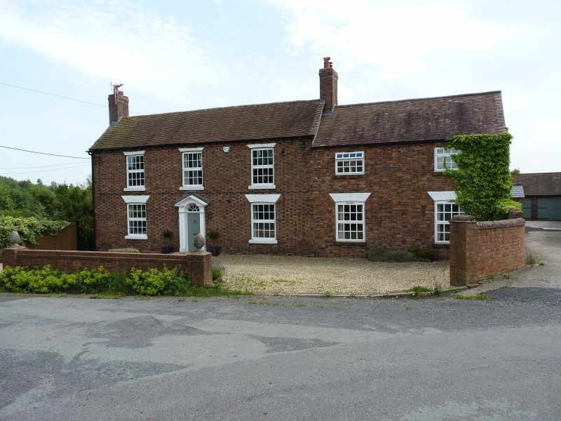
Early/mid C19 brick house. Tiled roof with gabled ends. Two-storeys. Three
window range. Sashes with glazing bars in segmental headed openings. Central
pilastered doorcase with broken pediment with traceried semi-circular fanlight and
flush panel door. Brick end stacks.
Listing NGR: SJ6607606676
External links are from the relevant listing authority and, where applicable, Wikidata. Wikidata IDs may be related buildings as well as this specific building. If you want to add or update a link, you will need to do so by editing the Wikidata entry.


Other nearby listed buildings
