Latitude: 52.8988 / 52°53'55"N
Longitude: -1.8649 / 1°51'53"W
OS Eastings: 409186
OS Northings: 333491
OS Grid: SK091334
Mapcode National: GBR 38R.9B7
Mapcode Global: WHCFP.BD6K
Plus Code: 9C4WV4XP+G3
Entry Name: 10, High Street
Listing Date: 26 March 1973
Grade: II
Source: Historic England
Source ID: 1038753
English Heritage Legacy ID: 272915
ID on this website: 101038753
Location: Uttoxeter, East Staffordshire, ST14
County: Staffordshire
District: East Staffordshire
Civil Parish: Uttoxeter
Built-Up Area: Uttoxeter
Traditional County: Staffordshire
Lieutenancy Area (Ceremonial County): Staffordshire
Church of England Parish: Uttoxeter St Mary Virgin
Church of England Diocese: Lichfield
Tagged with: Building
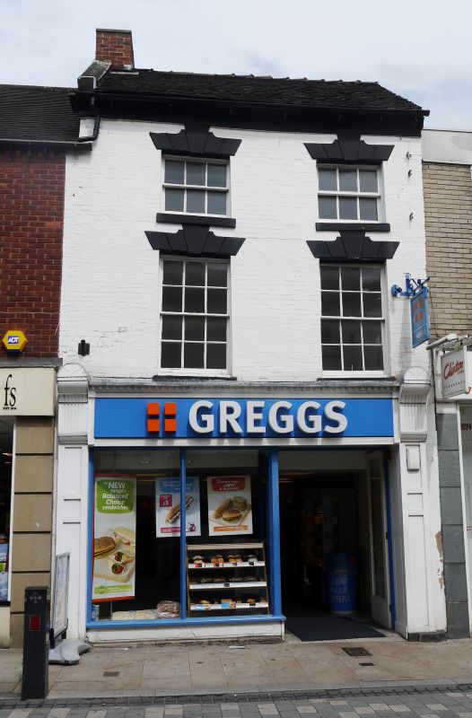
1. HIGH STREET
1756
(East Side)
No 10
SK 0933 1/100
II
2.
Late C18. Painted brick; 3 storeys; 2 sash windows with keyblocks and channelled
lintels (one upper blocked); coved plaster eaves; old tiles; modern shop
front.
Listing NGR: SK0918633491
External links are from the relevant listing authority and, where applicable, Wikidata. Wikidata IDs may be related buildings as well as this specific building. If you want to add or update a link, you will need to do so by editing the Wikidata entry.


Other nearby listed buildings