Latitude: 52.8979 / 52°53'52"N
Longitude: -1.8641 / 1°51'50"W
OS Eastings: 409240
OS Northings: 333395
OS Grid: SK092333
Mapcode National: GBR 38R.9K4
Mapcode Global: WHCFP.BFL7
Plus Code: 9C4WV4XP+59
Entry Name: 21, MARKET PLACE (See details for further address information)
Listing Date: 24 October 1950
Grade: II
Source: Historic England
Source ID: 1038759
English Heritage Legacy ID: 272933
ID on this website: 101038759
Location: Uttoxeter, East Staffordshire, ST14
County: Staffordshire
District: East Staffordshire
Civil Parish: Uttoxeter
Built-Up Area: Uttoxeter
Traditional County: Staffordshire
Lieutenancy Area (Ceremonial County): Staffordshire
Church of England Parish: Uttoxeter St Mary Virgin
Church of England Diocese: Lichfield
Tagged with: Building
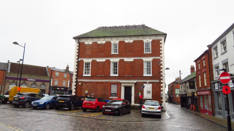
MARKET PLACE 1. 1756 No 21 SK 0933 1/45 24.10.50. II 2. (Corner of Queen Street) A good mid C18 house of red brick with rusticated stone quoins, and frieze and moulded cornice. 3 storeys; 5 sash windows, (2 with single glazing bars plus 2 blocked) with flat brick arches and moulded keyblocks. The 3rd storey has similar windows (3 blocked) and the ground floor 2 blocked and 2 turned into shop windows. Plain Tuscan doorcase with engaged columns, plain frieze and cornice; 6-panel door and traceried rectangular fanlight. 2 window frontage to Market Place has modern shop front.
Listing NGR: SK0924033395
External links are from the relevant listing authority and, where applicable, Wikidata. Wikidata IDs may be related buildings as well as this specific building. If you want to add or update a link, you will need to do so by editing the Wikidata entry.


Other nearby listed buildings