Approximate Location Map
Large Map »
Latitude: 52.6592 / 52°39'33"N
Longitude: -1.8553 / 1°51'19"W
OS Eastings: 409881
OS Northings: 306838
OS Grid: SK098068
Mapcode National: GBR 3CN.CQC
Mapcode Global: WHCGV.GFQ7
Plus Code: 9C4WM45V+MV
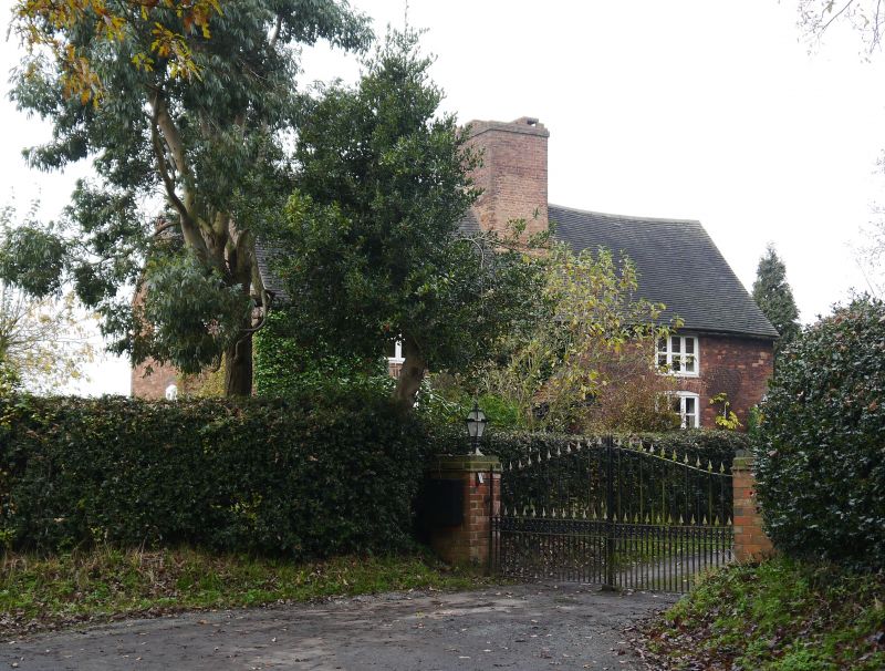
Entry Name: Wall Farmhouse
Listing Date: 15 January 1988
Grade: II
Source: Historic England
Source ID: 1038843
English Heritage Legacy ID: 272728
ID on this website: 101038843
Location: Wall, Lichfield, Staffordshire, WS14
County: Staffordshire
District: Lichfield
Civil Parish: Wall
Traditional County: Staffordshire
Lieutenancy Area (Ceremonial County): Staffordshire
Church of England Parish: Wall St John the Baptist
Church of England Diocese: Lichfield
Tagged with: Farmhouse
SK 00 NE
5/112
WALL C.P.
GREEN LANE
(east side)
Wall Farmhouse
II
Farmhouse. Mid C18 possibly to earlier core. Red brick with tiled
roof; massive central ridge stack. Two-storey, widely-spaced, two-
window front. 3-light casements, segmental-headed to ground floor;
central entrance with C20 lightweight gabled porch.
Listing NGR: SK0988106838
External links are from the relevant listing authority and, where applicable, Wikidata. Wikidata IDs may be related buildings as well as this specific building. If you want to add or update a link, you will need to do so by editing the Wikidata entry.


Other nearby listed buildings
