Latitude: 52.7226 / 52°43'21"N
Longitude: -1.7232 / 1°43'23"W
OS Eastings: 418792
OS Northings: 313920
OS Grid: SK187139
Mapcode National: GBR 4DD.94Z
Mapcode Global: WHCGJ.HTNN
Plus Code: 9C4WP7FG+2P
Entry Name: Chetwynd Bridge
Listing Date: 9 March 1953
Last Amended: 20 November 1986
Grade: II*
Source: Historic England
Source ID: 1038893
English Heritage Legacy ID: 272548
ID on this website: 101038893
Location: Lichfield, Staffordshire, WS13
County: Staffordshire
District: Lichfield
Civil Parish: Edingale
Traditional County: Staffordshire
Lieutenancy Area (Ceremonial County): Staffordshire
Church of England Parish: Alrewas All Saints
Church of England Diocese: Lichfield
SK 11 SE
4/61
TAMWORTH ROAD, A513
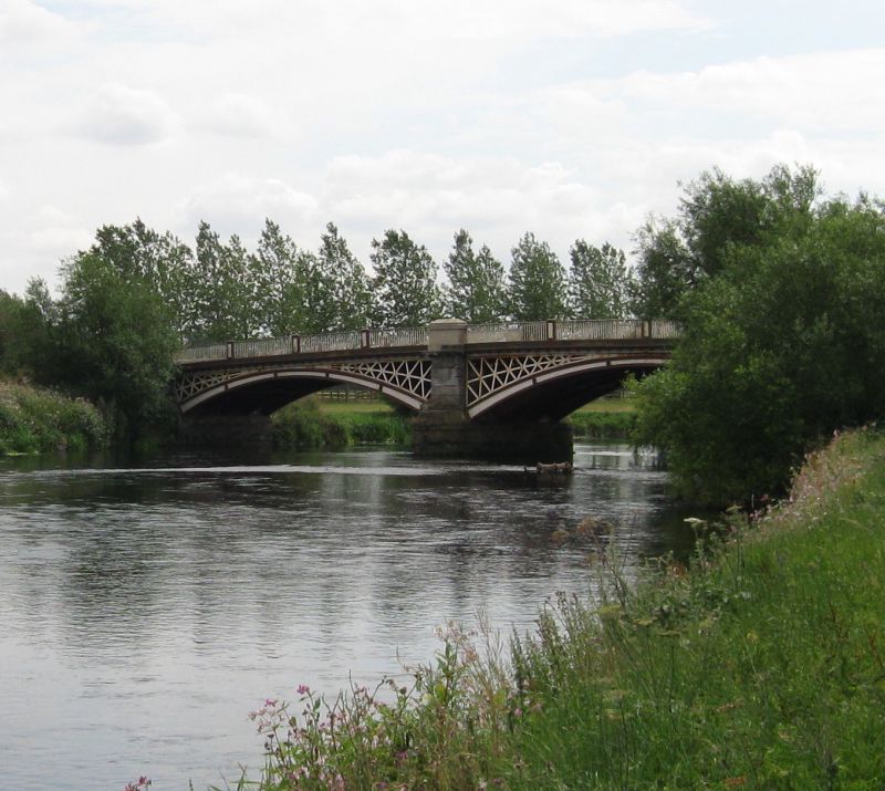
Chetwynd Bridge
(Formerly listed as "Salter's Bridge")
9.3.53
II*
Road bridge. Dated 1824. By Joseph Potter, the County Surveyor. Cast iron and rusticated ashlar. Three segmental arches spanning the River Tame with latticework spandrels and a balustrade interspersed with panelled piers; abutments sweep round to end buttresses and buttresses also flank the central arch. Inscribed "CHETWYND BRIDGE / ERECTED BY THE / COUNTY OF STAFFORD / 1824 / SR. G CHETWYND BT / CHAIRMAN OF THE / QUARTER SESSIONS / JOSEPH POTTER / COUNTY SURVEYOR".
The asset was previously listed twice also at List entry 1038825. That entry was removed from the List on 26 July 2016.
This entry was subject to a Minor Amendment on 26 July 2016.


Other nearby listed buildings