Approximate Location Map
Large Map »
Latitude: 52.3956 / 52°23'44"N
Longitude: -1.8391 / 1°50'20"W
OS Eastings: 411042
OS Northings: 277524
OS Grid: SP110775
Mapcode National: GBR 3GS.XG7
Mapcode Global: VH9ZJ.21KV
Plus Code: 9C4W95W6+78
Entry Name: Whitlocks Farmhouse
Listing Date: 22 July 1976
Grade: II
Source: Historic England
Source ID: 1039113
English Heritage Legacy ID: 218185
ID on this website: 101039113
Location: Three Maypoles, Solihull, West Midlands, B90
County: Solihull
Civil Parish: Dickens Heath
Built-Up Area: Dickens Heath
Traditional County: Warwickshire
Lieutenancy Area (Ceremonial County): West Midlands
Church of England Parish: Salter Street and Shirley
Church of England Diocese: Birmingham
Tagged with: Farmhouse
BILLS LANE
1.
5108 HOCKLEY HEATH
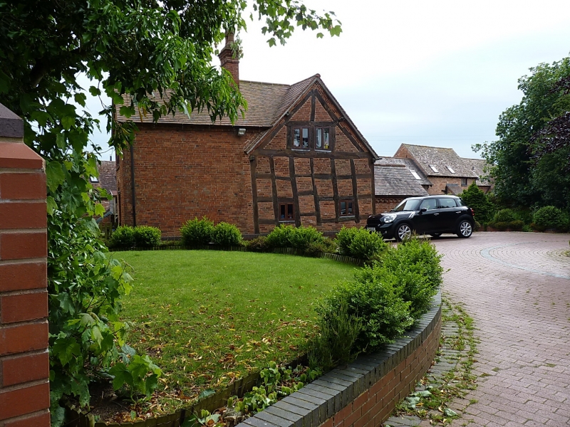
Whit locks Farmhouse
SP 17 NW 2/321
II
2.
C17. Brick front, timber frame and red brick nogging to back and side. Tiled roof.
2 storeys, 2 lattice casement windows.
Listing NGR: SP1104277524
External links are from the relevant listing authority and, where applicable, Wikidata. Wikidata IDs may be related buildings as well as this specific building. If you want to add or update a link, you will need to do so by editing the Wikidata entry.


Other nearby listed buildings
