Approximate Location Map
Large Map »
Latitude: 52.7681 / 52°46'5"N
Longitude: -2.1029 / 2°6'10"W
OS Eastings: 393152
OS Northings: 318953
OS Grid: SJ931189
Mapcode National: GBR 28N.H4Q
Mapcode Global: WHBF0.NPT7
Plus Code: 9C4VQV9W+7R
Entry Name: Acton Mill Bridge
Listing Date: 2 January 1986
Grade: II
Source: Historic England
Source ID: 1039250
English Heritage Legacy ID: 271667
ID on this website: 101039250
Location: Acton Gate, South Staffordshire, ST17
County: Staffordshire
District: South Staffordshire
Civil Parish: Acton Trussell and Bednall
Traditional County: Staffordshire
Lieutenancy Area (Ceremonial County): Staffordshire
Church of England Parish: Acton Trussell St James
Church of England Diocese: Lichfield
Tagged with: Road bridge
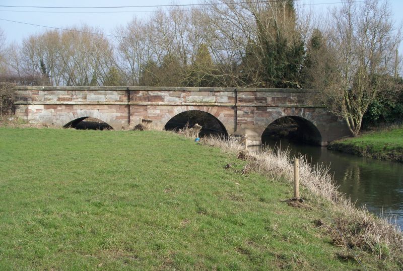
SJ 91 NW ACTON TRUSSELL, BEDNAL MILL LANE
AND TEDDESLEY HAY C.P.
3/19 Acton Mill Bridge
-
GV II
Road bridge. C18. Ashlar. 3 semi-circular arches spanning the
River Penk; 2 cutwaters continued upwards as flat buttresses; parapet
band to plain parapet with end piers of rectangular section.
Listing NGR: SJ9315218953
External links are from the relevant listing authority and, where applicable, Wikidata. Wikidata IDs may be related buildings as well as this specific building. If you want to add or update a link, you will need to do so by editing the Wikidata entry.


Other nearby listed buildings
