Latitude: 52.589 / 52°35'20"N
Longitude: -2.2651 / 2°15'54"W
OS Eastings: 382138
OS Northings: 299060
OS Grid: SO821990
Mapcode National: GBR 07X.Q4W
Mapcode Global: WHBFX.56N0
Plus Code: 9C4VHPQM+JX
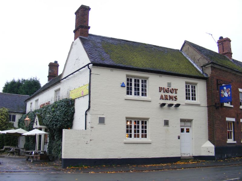
Entry Name: The Pigot Arms
Listing Date: 28 March 1985
Grade: II
Source: Historic England
Source ID: 1039300
English Heritage Legacy ID: 271487
ID on this website: 101039300
Location: Pattingham, South Staffordshire, WV6
County: Staffordshire
District: South Staffordshire
Civil Parish: Pattingham and Patshull
Built-Up Area: Pattingham
Traditional County: Staffordshire
Lieutenancy Area (Ceremonial County): Staffordshire
Church of England Parish: Pattingham St Chad
Church of England Diocese: Lichfield
Tagged with: Building
This list entry was subject to a Minor Amendment on 18/12/2017
SO 89 NW
11/184
PATTINGHAM CP
HIGH STREET (South side)
No 11, The Pigot Arms
(Formerly listed as The Piggot Arms, HIGH STREET)
GV
II
Public house. Early C19. Red brick and painted sandstone plinth; clay tile roof; brick stacks. Two storey main range and slightly lower two storey wing set-back to left. Main range: 2:1:2 windows; central pedimented bay projects slightly; glazing bar sashes with plaster lintels to ground floor and painted brick heads to first floor; central six panelled door, the upper two panels glazed; with shaped plaster lintels. Dentilled eaves course; two windows; glazing bar casements with painted stone lintels; Six panelled door to right, the upper two panels glazed.
Listing NGR: SO8213899060
External links are from the relevant listing authority and, where applicable, Wikidata. Wikidata IDs may be related buildings as well as this specific building. If you want to add or update a link, you will need to do so by editing the Wikidata entry.


Other nearby listed buildings