Approximate Location Map
Large Map »
Latitude: 51.383 / 51°22'58"N
Longitude: 0.3636 / 0°21'49"E
OS Eastings: 564577
OS Northings: 167535
OS Grid: TQ645675
Mapcode National: GBR NNB.8R8
Mapcode Global: VHJLR.8H3N
Plus Code: 9F3299M7+6F
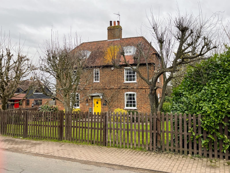
Entry Name: Norwood Farmhouse
Listing Date: 5 August 1982
Grade: II
Source: Historic England
Source ID: 1039912
English Heritage Legacy ID: 356811
ID on this website: 101039912
Location: Hook Green, Gravesham, Kent, DA13
County: Kent
District: Gravesham
Civil Parish: Meopham
Built-Up Area: Meopham
Traditional County: Kent
Lieutenancy Area (Ceremonial County): Kent
Church of England Parish: Meopham St John the Baptist
Church of England Diocese: Rochester
Tagged with: Farmhouse
TQ 66 NW MEOPHAM NORWOOD LANE
4/82
5.8.82 Norwood Farmhouse
II
C17. Two storeys with attics. Red brick with string course. Half-hipped tiled
roof. Central stack. Five sashes with glazing bars. Small pediment hood on brackets
to front door.
Listing NGR: TQ6457767535
External links are from the relevant listing authority and, where applicable, Wikidata. Wikidata IDs may be related buildings as well as this specific building. If you want to add or update a link, you will need to do so by editing the Wikidata entry.


Other nearby listed buildings
