Latitude: 54.9219 / 54°55'18"N
Longitude: -3.0565 / 3°3'23"W
OS Eastings: 332380
OS Northings: 559086
OS Grid: NY323590
Mapcode National: GBR 7C3J.2F
Mapcode Global: WH7ZV.0KS5
Plus Code: 9C6RWWCV+P9
Entry Name: Fauld Farm and Adjoining Outbuilding
Listing Date: 19 September 1984
Grade: II
Source: Historic England
Source ID: 1039913
English Heritage Legacy ID: 78219
ID on this website: 101039913
Location: Burgh by Sands, Cumberland, Cumbria, CA5
County: Cumberland
District: Carlisle
Civil Parish: Burgh by Sands
Built-Up Area: Burgh by Sands
Traditional County: Cumberland
Lieutenancy Area (Ceremonial County): Cumbria
Church of England Parish: Burgh-by-Sands St Michael
Church of England Diocese: Carlisle
Tagged with: Building
NY 3259 BURGH BY SANDS Burgh by Sands
13/34 Fauld Farm and adjoining outbuilding
II
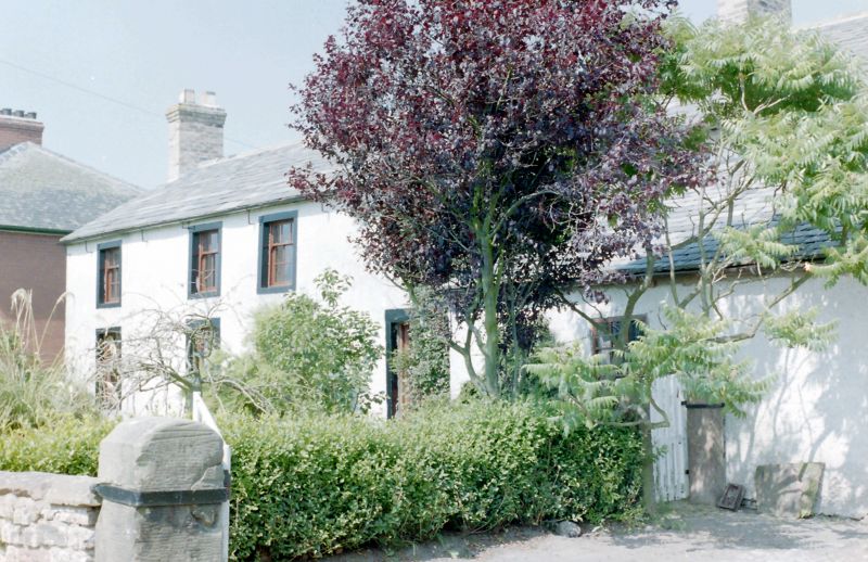
Farmhouse and former barn. Dated 1725 over entrance with initials T.H. (Thomas Hodgson). Whitewashed, rendered clay walls; graduated greenslate roof; yellow brick chimney stacks. 2 storeys, 4 bays, with 2-bay former barn to right under common roof. C20 door in plain painted stone surround with dated and inscribed lintel. Sash windows with glazing bars in plain painted stone surrounds. Former barn has single-storey extension to front with lean-to roof, and plank door in plain stone surround. Barn has plank door with loft door above in plain painted stone surrounds.
Listing NGR: NY3238059086
External links are from the relevant listing authority and, where applicable, Wikidata. Wikidata IDs may be related buildings as well as this specific building. If you want to add or update a link, you will need to do so by editing the Wikidata entry.


Other nearby listed buildings