Approximate Location Map
Large Map »
Latitude: 53.3028 / 53°18'10"N
Longitude: -1.4753 / 1°28'31"W
OS Eastings: 435060
OS Northings: 378559
OS Grid: SK350785
Mapcode National: GBR LZ47.DR
Mapcode Global: WHDF2.97PT
Plus Code: 9C5W8G3F+4V
Entry Name: Boundary wall enclosing gardens to properties to the north side of High Street to the west of Item 48
Listing Date: 7 July 1989
Grade: II
Source: Historic England
Source ID: 1040010
English Heritage Legacy ID: 79527
ID on this website: 101040010
Location: Dronfield, North East Derbyshire, S18
County: Derbyshire
District: North East Derbyshire
Civil Parish: Dronfield
Built-Up Area: Dronfield
Traditional County: Derbyshire
Lieutenancy Area (Ceremonial County): Derbyshire
Church of England Parish: Dronfield St John Baptist
Church of England Diocese: Derby
Tagged with: Wall
This list entry was subject to a Minor Amendment on 21 June 2022 to correct a typo in text and reformat to current standards
SK 37 NE
6/47
PARISH OF DRONFIELD
HIGH STREET (North Side)
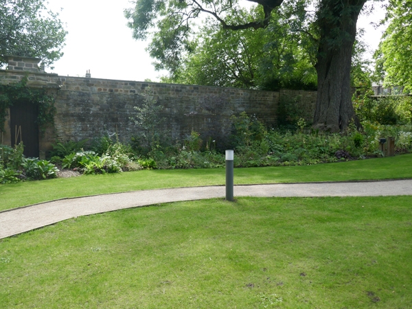
Boundary wall enclosing gardens to properties to the north side of High Street to the west of Item 48
GV
II
Boundary wall. Mid C17 and C18. Coursed coal measures sandstone. The wall varies between two and three metres in height, with both flat and half round copings. Projecting doorway area to centre part with chamfered quoined surround, massive lintel, with oversailing flagstones above, acting as a drip and above, in the plane of the attached wall, a raised masonry panel with a flat coping. Various shallow raking buttress along the irregular boundary of the wall, a number of blocked openings and a second plain doorway with a planked door.
Included for group value only.
Listing NGR: SK3506078559
External links are from the relevant listing authority and, where applicable, Wikidata. Wikidata IDs may be related buildings as well as this specific building. If you want to add or update a link, you will need to do so by editing the Wikidata entry.


Other nearby listed buildings
