Latitude: 55.4672 / 55°28'1"N
Longitude: -1.916 / 1°54'57"W
OS Eastings: 405406
OS Northings: 619267
OS Grid: NU054192
Mapcode National: GBR H516.ZZ
Mapcode Global: WH9ZY.JVT4
Plus Code: 9C7WF38M+VH
Entry Name: Percys Cross with Enclosing Wall and Railings
Listing Date: 31 December 1969
Grade: II*
Source: Historic England
Source ID: 1041952
English Heritage Legacy ID: 236558
Also known as: Percy's Cross, Beanley
Percys Cross
ID on this website: 101041952
Location: Northumberland, NE66
County: Northumberland
Civil Parish: Hedgeley
Traditional County: Northumberland
Lieutenancy Area (Ceremonial County): Northumberland
Church of England Parish: Eglingham St Maurice
Church of England Diocese: Newcastle
Tagged with: Wayside cross Stone cross
HEDGELEY A 697 NU 01 SE (East side) 4/214 Percy's Cross, with enclosing wall 31.12.69 and railings II*
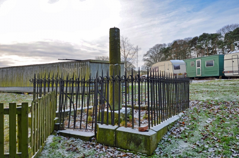
Wayside cross, later C15; C19 wall and railings. Sandstone, cast iron. Square socket stone carrying shaft with chamfered angles; each face bears relief carvings of crescents, fusils and lucies (pikes), with fetterlocks on the angle chamfers. Head missing; overall height c.3 metres. Enclosing dwarf wall with chamfered coping, carrying rails with barbed tops; similar gate on north.
The carved motifs are all Percy emblems; the cross commemorates Sir Ralph Percy, who fell leading the Lancastrian army at the battle of Hedgeley Moor, 23rd April 1464.
Listing NGR: NU0540619267
External links are from the relevant listing authority and, where applicable, Wikidata. Wikidata IDs may be related buildings as well as this specific building. If you want to add or update a link, you will need to do so by editing the Wikidata entry.


Other nearby listed buildings