Latitude: 55.6323 / 55°37'56"N
Longitude: -2.0835 / 2°5'0"W
OS Eastings: 394841
OS Northings: 637638
OS Grid: NT948376
Mapcode National: GBR F3W9.QT
Mapcode Global: WH9Z2.ZP1L
Plus Code: 9C7VJWJ8+WJ
Entry Name: Ford Smithy
Listing Date: 10 March 1988
Grade: II
Source: Historic England
Source ID: 1042157
English Heritage Legacy ID: 238078
ID on this website: 101042157
Location: Ford, Northumberland, TD15
County: Northumberland
Civil Parish: Ford
Traditional County: Northumberland
Lieutenancy Area (Ceremonial County): Northumberland
Church of England Parish: Ford And Etal
Church of England Diocese: Newcastle
Tagged with: Building
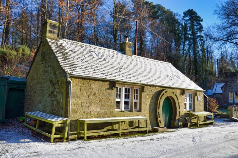
FORD FORD VILLAGE
NT 9437
17/111 Ford Smithy
GV II
Smithy. 1863 for the Marchioness of Waterford. Snecked stone with Welsh slate
roof. Single storey, 3 bays. Boarded double doors in raised horseshoe-
shaped surround. 3-light window to left, 2-light to right with shuttered
lower sections and 4-pane casements above. Gabled roof with ridge stack and
left end stack. Datestone on left gable with monogram of Lady Waterford.
Listing NGR: NT9484137638
External links are from the relevant listing authority and, where applicable, Wikidata. Wikidata IDs may be related buildings as well as this specific building. If you want to add or update a link, you will need to do so by editing the Wikidata entry.


Other nearby listed buildings