Latitude: 55.1538 / 55°9'13"N
Longitude: -1.9474 / 1°56'50"W
OS Eastings: 403448
OS Northings: 584383
OS Grid: NZ034843
Mapcode National: GBR G8VV.5B
Mapcode Global: WHB1H.1QYD
Plus Code: 9C7W5333+G2
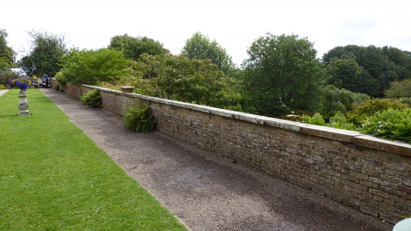
Entry Name: Terrace Wall in Walled Garden
Listing Date: 30 January 1986
Grade: II
Source: Historic England
Source ID: 1042868
English Heritage Legacy ID: 238467
ID on this website: 101042868
Location: Wallington, Northumberland, NE61
County: Northumberland
Civil Parish: Wallington Demesne
Traditional County: Northumberland
Lieutenancy Area (Ceremonial County): Northumberland
Church of England Parish: Cambo Holy Trinity
Church of England Diocese: Newcastle
Tagged with: Wall
WALLINGTON DEMESNE WALLINGTON NZ 0384 21/218 Terrace wall in Walled Garden GV II Terrace wall, c.1766. Brick in English Garden Wall bond, with stone dressings. Wall with flat coping and 7 piers, 3 carrying lead statues (Perseus, Dancing Girl and Venus) at time of survey. At foot of wall near centre, a spring with lion mask and stone trough.
Listing NGR: NZ0344884383
External links are from the relevant listing authority and, where applicable, Wikidata. Wikidata IDs may be related buildings as well as this specific building. If you want to add or update a link, you will need to do so by editing the Wikidata entry.


Other nearby listed buildings