Latitude: 50.8797 / 50°52'46"N
Longitude: 0.5865 / 0°35'11"E
OS Eastings: 582053
OS Northings: 112093
OS Grid: TQ820120
Mapcode National: GBR PWY.R38
Mapcode Global: FRA D63S.4BQ
Plus Code: 9F22VHHP+VJ
Entry Name: Church of St Helen
Listing Date: 19 January 1951
Last Amended: 14 September 1976
Grade: II
Source: Historic England
Source ID: 1043529
English Heritage Legacy ID: 293815
ID on this website: 101043529
Location: St Helen's, Hastings, East Sussex, TN34
County: East Sussex
District: Hastings
Electoral Ward/Division: St Helens
Parish: Non Civil Parish
Built-Up Area: Hastings
Traditional County: Sussex
Lieutenancy Area (Ceremonial County): East Sussex
Church of England Parish: Ore St Helen
Church of England Diocese: Chichester
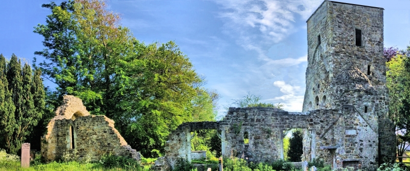
ELPHINSTONE ROAD 1. 5204 St Helens Church of St Helen (formerly listed under The Ridge) TQ 81 SW 2/233 19,1.51. II 2. Ruins of the old Parish Church of Ore, containing Norman and later work. They consist of the C12 tower at the west end, the north wall of nave (south nave wall has gone) and chancel containing 2 C15 square-headed windows and east wall of chancel with gable containing a pointed C14 window of 2 trefoil-headed lights with quatrefoil over.
Listing NGR: TQ8205312093


Other nearby listed buildings