Approximate Location Map
Large Map »
Latitude: 50.8595 / 50°51'34"N
Longitude: 0.5959 / 0°35'45"E
OS Eastings: 582789
OS Northings: 109880
OS Grid: TQ827098
Mapcode National: GBR QYP.1GF
Mapcode Global: FRA D64T.MZF
Plus Code: 9F22VH5W+R9
Entry Name: Churchyard Wall to West of All Saints Church
Listing Date: 14 September 1976
Grade: II
Source: Historic England
Source ID: 1043625
English Heritage Legacy ID: 293640
ID on this website: 101043625
Location: Old Town, Hastings, East Sussex, TN34
County: East Sussex
District: Hastings
Electoral Ward/Division: Old Hastings
Parish: Non Civil Parish
Built-Up Area: Hastings
Traditional County: Sussex
Lieutenancy Area (Ceremonial County): East Sussex
Church of England Parish: Hastings St Clement and All Saints
Church of England Diocese: Chichester
Tagged with: Churchyard wall
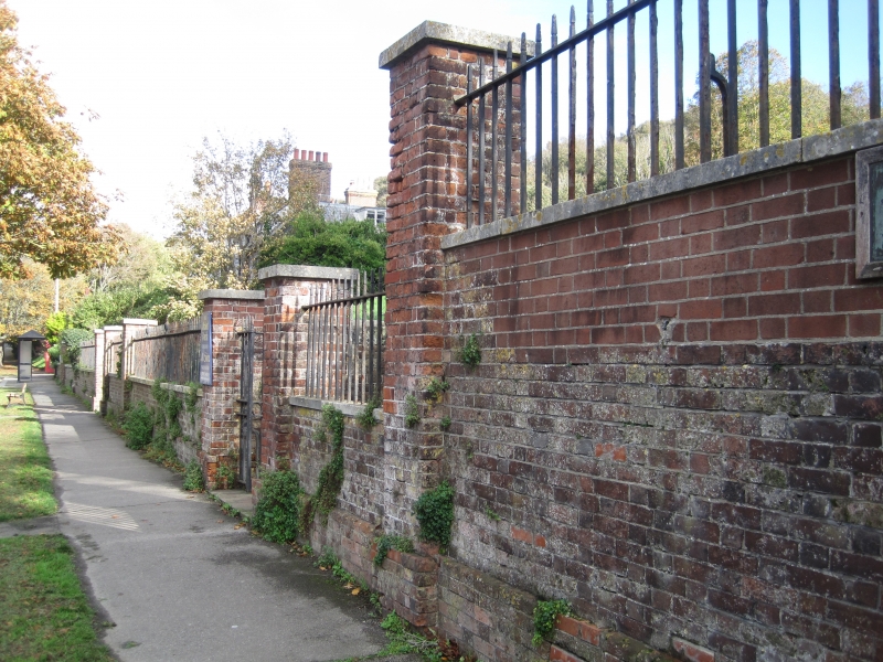
1.
5204 ALL SAINTS' STREET
(East Side)
Churchyard wall to west
of All Saints' Church
TQ 8209 NE 8/261
II GV
2.
Early C19. Low, red brick with plain stone coping, brick piers at intervals with
stone caps and iron railings with urn finials, including iron gates.
All the buildings in All Saints' Street form a group.
Listing NGR: TQ8278909880
External links are from the relevant listing authority and, where applicable, Wikidata. Wikidata IDs may be related buildings as well as this specific building. If you want to add or update a link, you will need to do so by editing the Wikidata entry.


Other nearby listed buildings
