Latitude: 50.9057 / 50°54'20"N
Longitude: 0.4016 / 0°24'5"E
OS Eastings: 568951
OS Northings: 114550
OS Grid: TQ689145
Mapcode National: GBR NV6.0CR
Mapcode Global: FRA C6QQ.488
Plus Code: 9F22WC42+7J
Entry Name: Parish Church of St Peter
Listing Date: 3 August 1961
Grade: I
Source: Historic England
Source ID: 1044264
English Heritage Legacy ID: 292047
Also known as: St Peter's Church, Ashburnham
ID on this website: 101044264
Location: St Peter's Church, The Pound, Rother, East Sussex, TN33
County: East Sussex
District: Rother
Civil Parish: Ashburnham
Traditional County: Sussex
Lieutenancy Area (Ceremonial County): East Sussex
Church of England Parish: Ashburnham St Peter
Church of England Diocese: Chichester
Tagged with: Church building
TQ 61 SE ASHBURNHAM CHURCH ROAD
28/15 Parish Church of St Peter 3.8.61 I
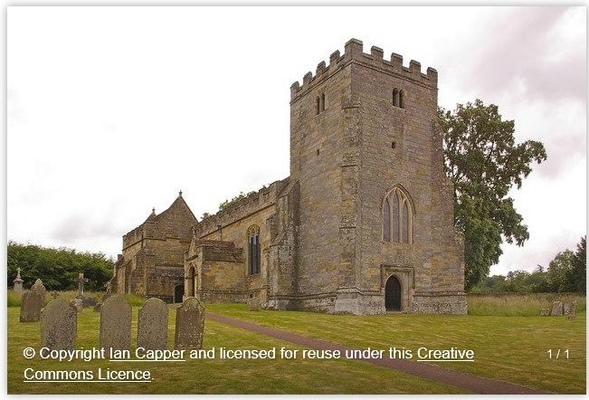
Chancel with north and south chapels, nave, north porch and west tower. The tower is C15. The remainder of the building would seem of the same date but was actually rebuilt by John Ashburnham in 1663 and is one of the best examples in England of the Gothic style continuing after the Gothic period was over. The interior retains all its contemporary C17 fittings: the iron screens to the chancel, chapels and tower, the communion rails, pulpit, former reredos of the ten commandments and the gallery in the tower supported on wooden Ionic columns. C18 box-pews. The north chapel is the Ashburnham mausoleum chapel and contains two very good C17 family monuments, one by Bushnell. The south chapel formerly contained the Ashburnham family pew as a gallery but this has now been blocked off as a room for private prayer.
Listing NGR: TQ6895114550
External links are from the relevant listing authority and, where applicable, Wikidata. Wikidata IDs may be related buildings as well as this specific building. If you want to add or update a link, you will need to do so by editing the Wikidata entry.


Other nearby listed buildings