Approximate Location Map
Large Map »
Latitude: 50.9503 / 50°57'1"N
Longitude: 0.7346 / 0°44'4"E
OS Eastings: 592176
OS Northings: 120322
OS Grid: TQ921203
Mapcode National: GBR RZ1.6K9
Mapcode Global: FRA D6FL.N04
Plus Code: 9F22XP2M+4R
Entry Name: The Water Tower (Standing in the North East Corner of the Churchyard)
Listing Date: 12 October 1951
Grade: II*
Source: Historic England
Source ID: 1044326
English Heritage Legacy ID: 291907
Also known as: Water tower in churchyard
ID on this website: 101044326
Location: Rye, Rother, East Sussex, TN31
County: East Sussex
District: Rother
Civil Parish: Rye
Built-Up Area: Rye
Traditional County: Sussex
Lieutenancy Area (Ceremonial County): East Sussex
Church of England Parish: Rye
Church of England Diocese: Chichester
Tagged with: Water tower
1.
1578 CHURCH SQUARE
The Water Tower
(standing in the north-
east corner of the churchyard)
TQ 9220 1/2 12.l0.51.
II* GV
2.
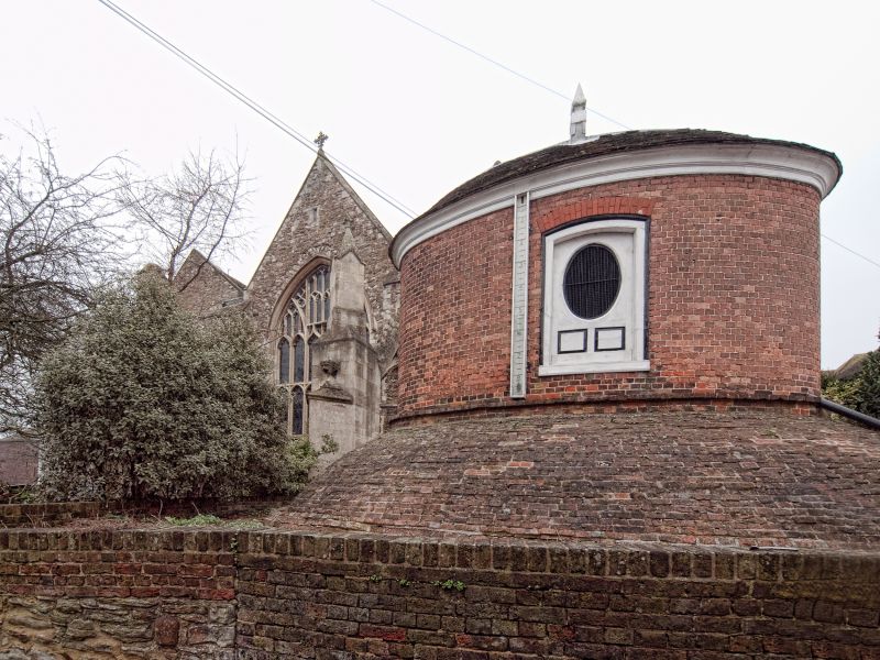
The Water Tower is scheduled as an AM. Erected in 1733-1735. Red brick.
Built in 2 sections, both oval in shape, the lower having a coved brick
roof forming half a dome surmounted at its inner ridge or apex by the upper
section. Tiled-roof with a lead ridge and a pointed wooden pinnacle.
On the east and west sides of the upper section are rectangular openings
with segmental heads containing wooden shutters with oval openings in the
centre. The lead pump attached is dated 1826.
The Water Tower, Nos 1 to 5 (odd) and Nos 2 to 12 (even) form a group.
Listing NGR: TQ9217620322
External links are from the relevant listing authority and, where applicable, Wikidata. Wikidata IDs may be related buildings as well as this specific building. If you want to add or update a link, you will need to do so by editing the Wikidata entry.


Other nearby listed buildings
