Latitude: 54.9894 / 54°59'21"N
Longitude: -2.5729 / 2°34'22"W
OS Eastings: 363439
OS Northings: 566244
OS Grid: NY634662
Mapcode National: GBR BBGR.S7
Mapcode Global: WH90T.GV1D
Plus Code: 9C6VXCQG+QR
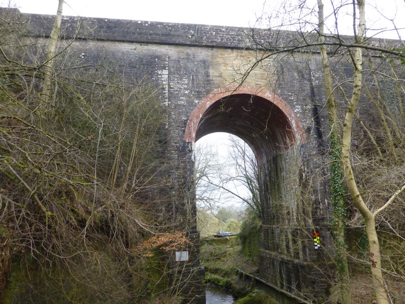
Entry Name: Railway Bridge Across the Poltross Burn North of Milecastle 48 Hadrians Wall
Listing Date: 27 July 1987
Grade: II
Source: Historic England
Source ID: 1045226
English Heritage Legacy ID: 240841
ID on this website: 101045226
Location: Gilsland, Cumberland, Cumbria, CA8
County: Northumberland
District: Carlisle
Civil Parish: Thirlwall
Built-Up Area: Gilsland
Traditional County: Cumberland
Lieutenancy Area (Ceremonial County): Northumberland
Church of England Parish: Gilsland St Mary Magdalene
Church of England Diocese: Carlisle
Tagged with: Railway bridge
THIRLWALL B 6318 NY 66 NW (South side, off) Gilsland 10/35 Railway Bridge across the Poltross Burn, north of Milecastle 48, Hadrian's wall II
Railway bridge, c.1838 possibly by Benjamin Green for the Newcastle and Carlisle Railway Co. Snecked dressed stone; rebuilt brick arch and tunnel. Bridge spans the narrow and steep-sided valley of the Poltross Burn. Very tall and narrow round archway. Rebuilt arch in 5 rows of header bond. Side walls supporting arch have 2 offsets near base. Front and rear wall flanking arch break forward and are battered. Horizontal parapet, above band at track level, has chamfered coping and breaks forward over end piers.
G. Whittle, The Newcastle and Carlisle Railway, 1979
Listing NGR: NY6343966244
External links are from the relevant listing authority and, where applicable, Wikidata. Wikidata IDs may be related buildings as well as this specific building. If you want to add or update a link, you will need to do so by editing the Wikidata entry.


Other nearby listed buildings