Approximate Location Map
Large Map »
Latitude: 53.3659 / 53°21'57"N
Longitude: -1.0682 / 1°4'5"W
OS Eastings: 462103
OS Northings: 385855
OS Grid: SK621858
Mapcode National: GBR NYZJ.J4
Mapcode Global: WHFG0.KNKG
Plus Code: 9C5W9W8J+9P
Entry Name: Bridge
Listing Date: 12 April 1985
Grade: II
Source: Historic England
Source ID: 1045723
English Heritage Legacy ID: 241434
ID on this website: 101045723
Location: Bassetlaw, Nottinghamshire, S81
County: Nottinghamshire
District: Bassetlaw
Civil Parish: Hodsock
Traditional County: Nottinghamshire
Lieutenancy Area (Ceremonial County): Nottinghamshire
Church of England Parish: Blyth
Church of England Diocese: Southwell and Nottingham
Tagged with: Building
This list entry was subject to a Minor Amendment on 9 October 2023 to correct a typo in the description and to reformat the text to current standards
SK 68 NW
3/80
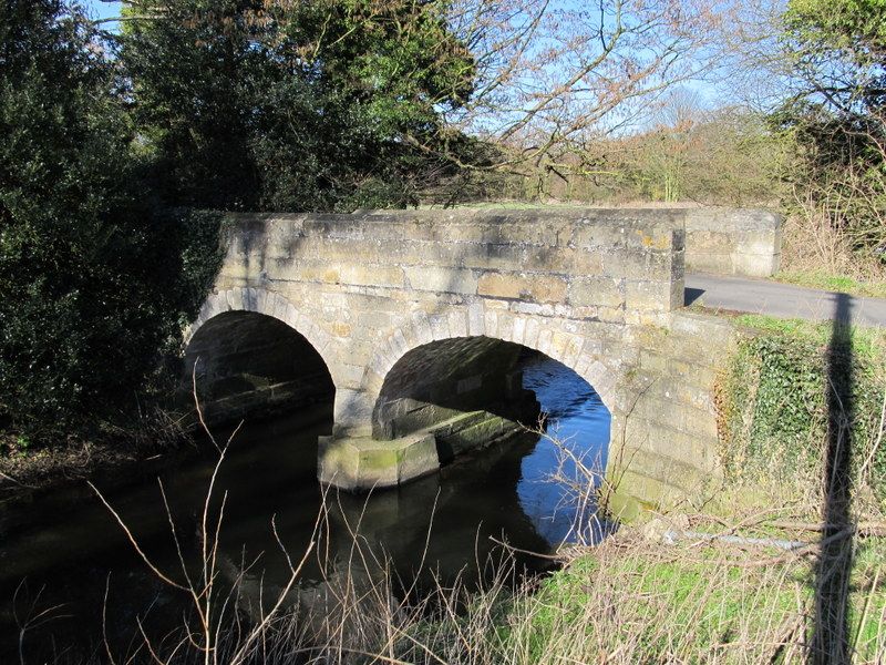
HODSOCK
HODSOCK PRIORY LANE
Bridge
II
Bridge. Early C19 Ashlar. Two arches with single central cutwater. Ashlar parapet with chamfered coping. Retaining wall to south east.
Listing NGR: SK6210085851
External links are from the relevant listing authority and, where applicable, Wikidata. Wikidata IDs may be related buildings as well as this specific building. If you want to add or update a link, you will need to do so by editing the Wikidata entry.


Other nearby listed buildings
