Approximate Location Map
Large Map »
Latitude: 53.2684 / 53°16'6"N
Longitude: -1.2931 / 1°17'35"W
OS Eastings: 447245
OS Northings: 374830
OS Grid: SK472748
Mapcode National: GBR MZDN.V3
Mapcode Global: WHDFC.33JQ
Plus Code: 9C5W7P94+8Q
Entry Name: Ruins of Romeley Hall
Listing Date: 23 March 1989
Grade: II
Source: Historic England
Source ID: 1045913
English Heritage Legacy ID: 79286
ID on this website: 101045913
Location: Stanfree, Bolsover, Derbyshire, S44
County: Derbyshire
District: Bolsover
Civil Parish: Clowne
Traditional County: Derbyshire
Lieutenancy Area (Ceremonial County): Derbyshire
Church of England Parish: Clowne St John the Baptist
Church of England Diocese: Derby
Tagged with: Building
This list entry was subject to a Minor Amendment on 13 October 2023 to amend the name, address and reformat the text to current standards
SK 47 SE
4/116
PARISH OF CLOWNE
ROMELEY LANE
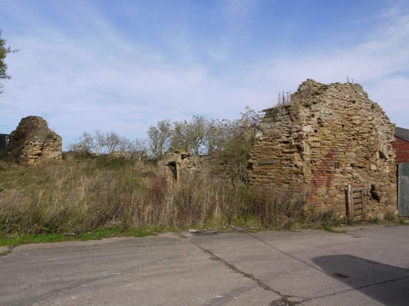
Ruins of Romeley Hall
(Formerly listed as OFF LOW ROAD (West Side) Ruins of Romiley Hall)
II
Ruins of a small country house. Early C17. Coursed rubble sandstone with sandstone dressings. Roofless. Reduced to a single storey. The main elevation has a doorway with chamfered stone surround, and the remains of two three-light recessed and chamfered mullion and transom windows. Inside, the hall has the remains of a 15 foot cambered stone arch. Sources:'The Derbyshire Country House' by M. Craven & M. Stanley. 1982 p58.
Listing NGR: SK4724574830
External links are from the relevant listing authority and, where applicable, Wikidata. Wikidata IDs may be related buildings as well as this specific building. If you want to add or update a link, you will need to do so by editing the Wikidata entry.


Other nearby listed buildings
