Approximate Location Map
Large Map »
Latitude: 53.075 / 53°4'30"N
Longitude: -0.976 / 0°58'33"W
OS Eastings: 468696
OS Northings: 353579
OS Grid: SK686535
Mapcode National: GBR BK3.62B
Mapcode Global: WHFHD.ZYCZ
Plus Code: 9C5X32GF+2H
Entry Name: Hall Farmhouse
Listing Date: 9 February 1973
Grade: II
Source: Historic England
Source ID: 1046057
English Heritage Legacy ID: 242518
ID on this website: 101046057
Location: Westhorpe, Newark and Sherwood, Nottinghamshire, NG25
County: Nottinghamshire
District: Newark and Sherwood
Civil Parish: Southwell
Built-Up Area: Southwell
Traditional County: Nottinghamshire
Lieutenancy Area (Ceremonial County): Nottinghamshire
Church of England Parish: Southwell Holy Trinity
Church of England Diocese: Southwell and Nottingham
Tagged with: Farmhouse
SOUTHWELL
WESTHORPE, Westhorpe
SK6853
1919-0/9/237 (North side)
09/02/73 No.80
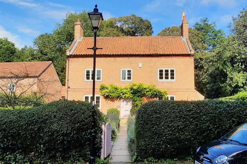
Hall Farmhouse.
II
Farmhouse, now a house. Late C18. Brick with pantile roof.
First floor band, cogged eaves, coped gables, 2 gable stacks.
Windows are 2-light and 3-light casements. All front openings
have segmental heads. 2 storeys; 3 window range. L-plan. Front
has a central 2-light casement flanked by single larger
casements. Central C19 half-glazed door flanked by single
casements. 2 storey gabled rear wing.
Listing NGR: SK6869653579
External links are from the relevant listing authority and, where applicable, Wikidata. Wikidata IDs may be related buildings as well as this specific building. If you want to add or update a link, you will need to do so by editing the Wikidata entry.


Other nearby listed buildings
