Approximate Location Map
Large Map »
Latitude: 53.0792 / 53°4'45"N
Longitude: -0.953 / 0°57'10"W
OS Eastings: 470230
OS Northings: 354065
OS Grid: SK702540
Mapcode National: GBR BJX.ZVT
Mapcode Global: WHFHF.BVDS
Plus Code: 9C5X32HW+MQ
Entry Name: Harvest
Listing Date: 9 February 1973
Grade: II
Source: Historic England
Source ID: 1046132
English Heritage Legacy ID: 242392
ID on this website: 101046132
Location: Southwell, Newark and Sherwood, Nottinghamshire, NG25
County: Nottinghamshire
District: Newark and Sherwood
Civil Parish: Southwell
Built-Up Area: Southwell
Traditional County: Nottinghamshire
Lieutenancy Area (Ceremonial County): Nottinghamshire
Church of England Parish: Southwell St Mary the Virgin
Church of England Diocese: Southwell and Nottingham
Tagged with: Building
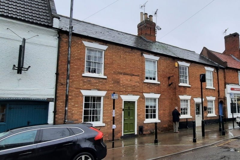
SOUTHWELL
KING STREET
SK7054
1919-0/7/95 (North West side)
09/02/73 Nos.49 & 51
Harvest (51)
GV II
Pair of houses, the right hand one now a shop. Early C19.
Brick with stone dressings and slate roofs. Single ridge
stack. Windows are glazing bar sashes with splayed lintels
with keystones. 2 storeys; 4 window range. Double fronted.
Each has 2 windows on each floor, and a central door flanked
by a round headed scraper. 51, to right, has sunblinds to the
ground floor. To the right, a round headed entry opening.
Listing NGR: SK7023054065
External links are from the relevant listing authority and, where applicable, Wikidata. Wikidata IDs may be related buildings as well as this specific building. If you want to add or update a link, you will need to do so by editing the Wikidata entry.


Other nearby listed buildings
